Severe Storms Possible Later Tonight/Tonight
Brian will be along shortly with a new Weather Xtreme video… this is a look at what to expect over the next 24 hours.
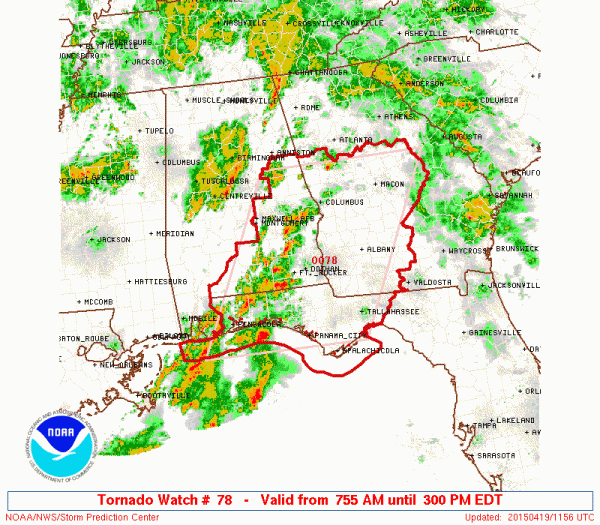
RIGHT NOW: Rain and storms continue over much of North/Central Alabama this morning with heavy rain in spots. Organized severe weather is not expected over the northern half of the state, and this activity will slowly diminish later this morning. We should note severe storms are possible over South Alabama this morning; in fact SPC has issued a tornado watch much of Southeast Alabama until 3:00 this afternoon.
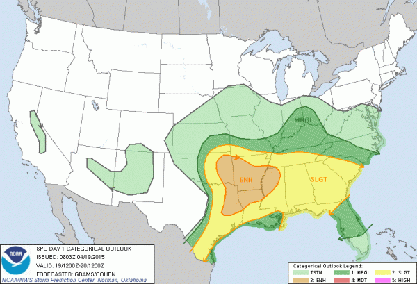
LATER TODAY AND TONIGHT: SPC has all of Alabama in the standard “slight risk” of severe weather…
Seems like we have two potential windows for severe storms.
One will come this afternoon when a disturbance (MCV) approaches from the west, and instability reaches a peak (ML CAPE values over 1,500 j/kg). Bulk shear values are not too impressive, and the tornado threat seems low. But, stronger storms during the afternoon could produce hail, and strong straight line winds where bowing segments develop.
Then, late tonight, more storms are likely ahead of the surface cold front. Most of this will come from about midnight tonight through 6:00 a.m. tomorrow. While there will be an increase in the low level jet (winds about 5,000 feet off the ground), the air will be pretty worked over across Alabama from previous storms, and the core dynamic support will lift northeast, away from us. A good chance the storms will weaken as they move through, but there still is some risk of a few storms with hail and gusty winds. The tornado threat late tonight is not zero, but very low.
And, don’t forget… when it comes to thunderstorms, expect the unexpected, so we will keep a very close eye on thunderstorm/radar trends today and tonight. Stay tuned for updates.
Category: Alabama's Weather


