Weekend Weather Update
This is a busy weekend for many with spring sports in full swing, and the two “A-Day” football games ahead at Tuscaloosa and Auburn.
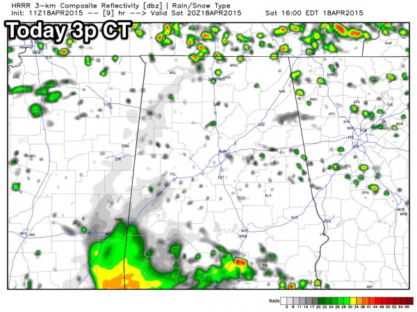
The good news is that there is no rain on radar as of 8:00 this morning, and most of the morning should be rain-free. No doubt a few showers will begin to form this afternoon, but the good news is that it looks like the most widespread rain will hold off until tonight. This is model output from the high resolution HRRR model, valid at 3pm today…
So yes, take the rain gear to Bryant-Denny Stadium and Jordan-Hare Stadium, but there is a real chance both games will be played with few showers. Temperatures will be in the 70s this afternoon.
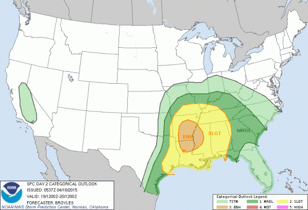
TOMORROW: Much of Alabama is in the standard “slight risk” of severe weather tomorrow…
There will be two main windows for strong storms… the first window will come from around 2 a.m. until 8 a.m. tomorrow; this will be more of a heavy rain event with limited instability, but a storm with hail and strong gusty winds can’t be ruled out. And, while the tornado threat is low, it is not zero.
There should be a lull in the action Sunday afternoon… then the second chance comes tomorrow night into the pre-dawn hours Monday… from about 10:00 p.m. tomorrow until 4:00 a.m. Monday. This is when the core dynamic support from the ejecting upper trough comes into play. While it will be slowly weakening, the air will be more unstable, and projected shear profiles and lapse rates hint that some of the storms could produce strong, perhaps damaging winds, and an isolated tornado will be possible.
Stay tuned to the blog for updates…
Category: Alabama's Weather


