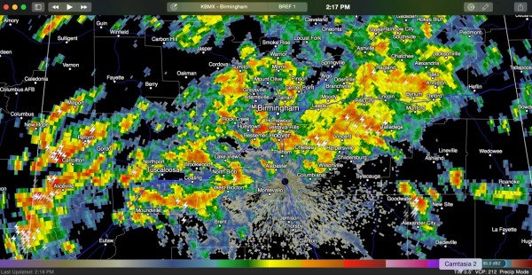
Rain and Storms Continue to Develop
Heavy rain continues to develop in the I-20 corridor at this hour, with moderate to heavy rain all the way from the Pell City area westward into Jefferson and Shelby Counties they through Tuscaloosa and on into Pickens and Sumter Counties.
The heaviest accumulations according to radar estimates are over:
…southwestern Winston County
…Central Fayette County
…Central Tuscaloosa County around the City of Tuscaloosa and Holt
…over northeastern Tuscaloosa County into Southwestern Jefferson County
Some areas have picked up between 2-3 inches of rainfall.
An areal flood warning is in effect for southern Cullman County.
There is a good bit of embedded thunder involved as well, but the storms are not strong.
Rain and storms will continue to develop thanks to a backdoor cold front that has pushed into the area and uplift over the boundary of a moist southwesterly flow aloft as well as a passing upper level wind max that is helping increase upward motion.
Category: Alabama's Weather, Severe Weather


