Flooding Concerns Increasing
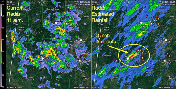
Rain and thunderstorms have increased this morning over the southwestern half of the area, generally west of I-65 and south of US-280.
Rainfall has been especially heavy over the northern half of the City of Tuscaloosa over the past hour or so, with radar estimates indicating well over two inches of rain this morning. The NWS Birmingham has issued a flood advisory for much of Tuscaloosa County.
The heaviest activity now extends from southwestern Cullman across Walker, western Jefferson, Tuscaloosa, western Bibb, Pickens and Greene Counties.
Recent rains have set the stage for grounds to become quickly saturated and heavy rainfall will be running off. There will be minor flooding in urban areas and quick rises on small streams. If prolonged heavy rains fall, more serious flooding is possible.
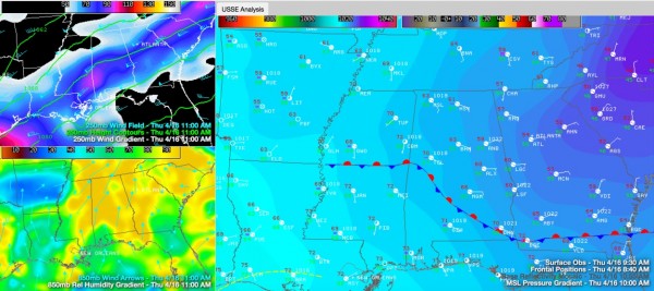
The rain and storms are coming from a two pronged attack this morning. At the surface, we find a back door cold front at the leading edge of an easterly wedge nosing in from Georgia. This front is acting as a focusing mechanism for convection. Above the surface, winds are out of the southwest, providing a stream of moisture from the Gulf of Mexico that is riding up and over the wedge, providing for efficient precipitation making. Throw in an approaching wind max at the jetstream level that will provide additional lift as we go through the afternoon and we have the makings of a major rainy day for many.
Instability values to the west or ahead of the front are low to moderate, hence there is a good bit of lightning and thunder. Fortunately however, there is very low shear and not much chance for the storms to be severe. There will be loud booming thunder though in ddition to the threat for heavy rainfall and flooding.
Category: Alabama's Weather, Severe Weather


