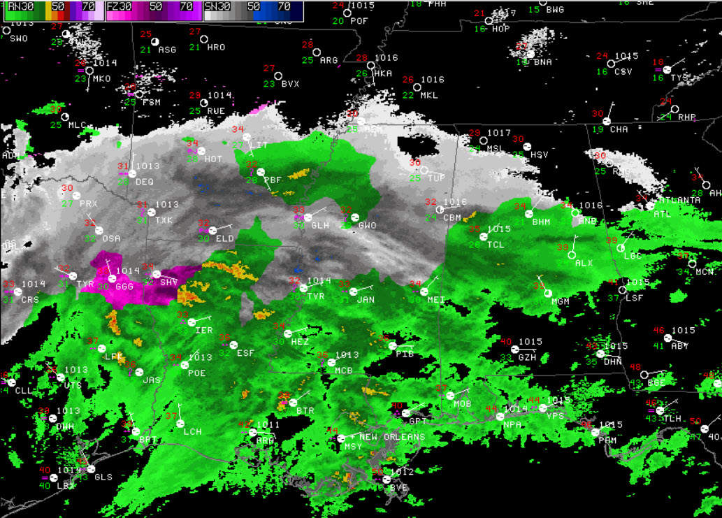
Mid-Morning Radar Check
A very busy day of weather is underway across the state. A large precipitation shield is spreading east into the state. We are beginning to get numerous reports of a rain/sleet mix across West-Central Alabama. Once again, this is what was expected. Farther to the west, snow is increasing across Arkansas with event some thunder and lightning mixed it. Through the morning, we will continue to see precip spreading east, and with the dynamic processes of the atmosphere, we will see the transition to snow. A reminder, the temperatures do not have to be below freezing at the surface to see snow or sleet fall.
The precip will begin falling heavier and will be dragging colder air down from the upper-atmosphere, which will allow for snow to reach the surface. We are in store for many hours of frozen precip across the state. We have been saying that the southern edge of the snow accumulations will be a very tight gradient, and a few miles will make a big difference. Interstate 20 still looks to be the main defining line. To the north, U.S. 278 from Hamilton, Cullman, and Gadsden still appears to be where the highest snowfall totals will be.
REMEMBER: With any winter weather event in Alabama, THERE WILL BE SURPRISES! There are going to be happy people today as well as disappointed people. Nevertheless, this is a significant winter weather event for the North-Central Alabama which will cause travel impacts and could produce some power outages.
ALABAMA POWER IS READY, ARE YOU? Our friends at Alabama Power are monitoring the forecast closely, ready to deploy people and assets to quickly address any outages that might occur. Read a special message from Ike Piggot about their commitment to their customers.
Category: Alabama's Weather, Winter Weather


