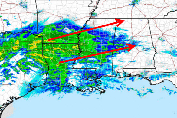
Precip Moving Into Alabama
Looking at the radar to the west, there is a lot of precipitation across the Mississippi Valley, and it is moving east. The radar is beginning to fill in across Mississippi and precip is moving into West Alabama. At this time, there are reports of light rain over West Alabama, and this exactly what we expected to occur. The event begins as rain, but by late morning as the rain begins to fall heavier, this is when we will see the quick transition to a frozen event. We should see rain change to sleet, then over to snow by this afternoon. The snow should last through the afternoon and evening hours, before winding down tonight.
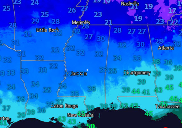
Now to those ever important temperatures. Temperatures are slowly increasing across the state this morning and many areas will be just above freezing as the event begins. However, as heavier rain moves into the area, we are expecting dynamic cooling which is caused by heavy precip falling and dragging colder air down through the atmosphere towards the surface. This will help cool the atmospheric column to below freezing and eventually cause surface temps to decrease as well. By this afternoon, as the surface temps drop back to freezing, is when we to see impacts on travel. We still have a few hours before things get very interesting. Check the blog for frequent updates today especially once the event begins to get underway!
ALABAMA POWER IS READY, ARE YOU? Our friends at Alabama Power are monitoring the forecast closely, ready to deploy people and assets to quickly address any outages that might occur. Read a special message from Ike Piggot about their commitment to their customers.
Category: Alabama's Weather, Winter Weather


