New Model Data Rolling In
We are still working two winter weather events for Alabama… the first is tonight and tomorrow morning due to a “wintry mix”, especially freezing rain.
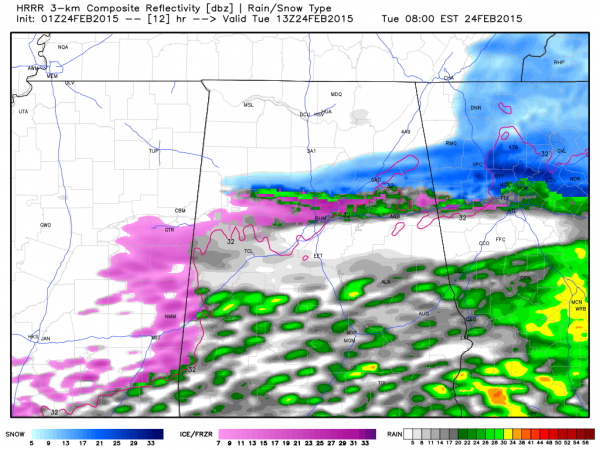
NEXT 15 HOURS: We still expect icy travel late tonight into tomorrow morning. The HRRR continues to show a mixed bag of snow, sleet, and freezing rain tomorrow (map below is valid at 7am CT)
Icy bridges and roads are possible across North and Central Alabama, as far south as a line from Demopolis to Marion to Clanton to Roanoke, through mid-morning when temperatures rise above freezing (9-10am). Be very careful if you have to drive tonight; Birmingham is down to 33 degrees at 9:00, and ice could begin to form on bridges in the metro area anytime after 10:00.
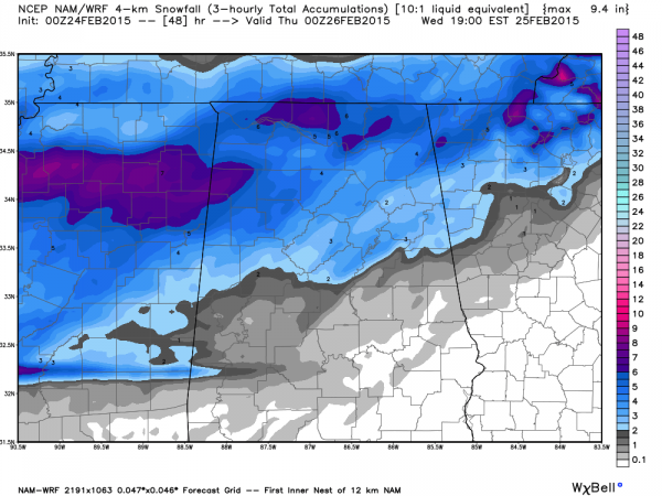
WEDNESDAY: The new 00Z NAM run is in, and suggests our forecast potential of 2-4″ of snow Wednesday is on target…
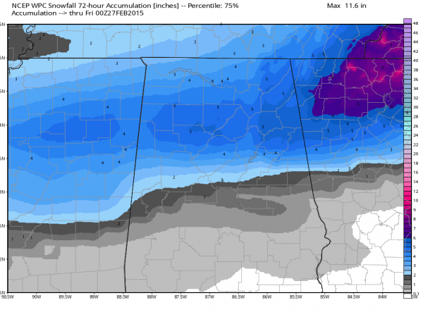
This is the forecast from the guys at WPC/NCEP…
TIMING: Still looks like the snow (perhaps mixed with some rain/sleet at the onset) will begin in the 6:00 a.m. to 10:00 a.m. time frame Wednesday; the snow becomes heavier Wednesday afternoon before ending Wednesday night.
IMPACT: This could be a high impact event with very significant travel issues Wednesday and Wednesday night, and most likely into Thursday morning as well. Where very heavy, wet snow falls a few scattered power outages are possible as well.
PLACEMENT: One of the hardest part of this forecast is defining the southern extent of the snow, and the northern extent of the rain. This rain/snow line will most likely be south of I-20.
REMEMBER: This forecast can, and probably will change. Be sure and check for new updates later tonight and early tomorrow.
ALABAMA POWER IS READY, ARE YOU? Our friends at Alabama Power are monitoring the forecast closely, ready to deploy people and assets to quickly address any outages that might occur. Read a special message from Ike Pigott about their commitment to their customers.
Category: Alabama's Weather


