Evening Update
A winter weather advisory is in effect tonight for much of North/Central Alabama for the potential for light freezing rain/sleet.
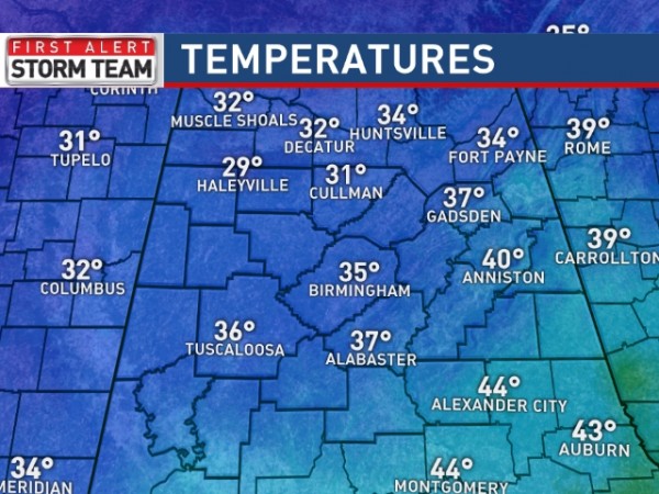
TEMPERATURES: They are below freezing now over parts of North and Northwest Alabama…
Counties like Marion, Winston, Franklin, Lawrence, Cullman, Fayette, and Lamar can expect icy travel anytime tonight and early tomorrow morning.
The freeze line should reach Tuscaloosa, Birmingham, Anniston, and Gadsden in the 10:00 to 12:00 midnight time frame; after that icy patches will likely develop on bridges and some roads.
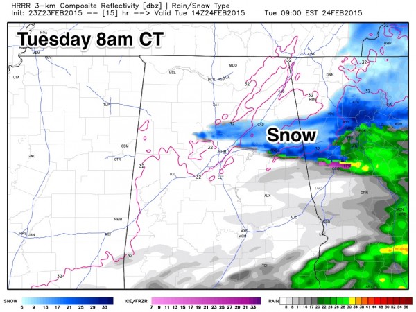
TOMORROW MORNING: Interesting to note the high resolution HRRR model shows precipitation changing to snow over East Alabama before ending tomorrow morning…
So, some of you might have a bit of snow early tomorrow. Temperatures should rise above freezing by 10:00 a.m. and roads should be fine tomorrow afternoon and tomorrow night.
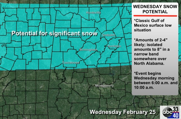
ROUND TWO: Models still suggest potential for a significant winter snow event for North/Central Alabama Wednesday. We are using an average potential of 2-4″ with isolated amounts to 8″ where the heavier snow band sets up (that is usually a very narrow zone).
The snow should begin Wednesday morning sometime between 6:00 and 10:00 a.m.
MAIN CHALLENGES IN WEDNESDAY’S FORECAST: The southern extent of the snow. For now, we figure most of the snow will be north of a line from Eutaw to Brent to Jemison to Roanoke. Could there be some snow south of that line? Yes.
Understand this forecast can, and will change. Stay tuned…
ALABAMA POWER IS READY, ARE YOU? Our friends at Alabama Power are monitoring the forecast closely, ready to deploy people and assets to quickly address any outages that might occur. Read a special message from Ike Pigott about their commitment to their customers.
Category: Alabama's Weather


