Who Gets What?
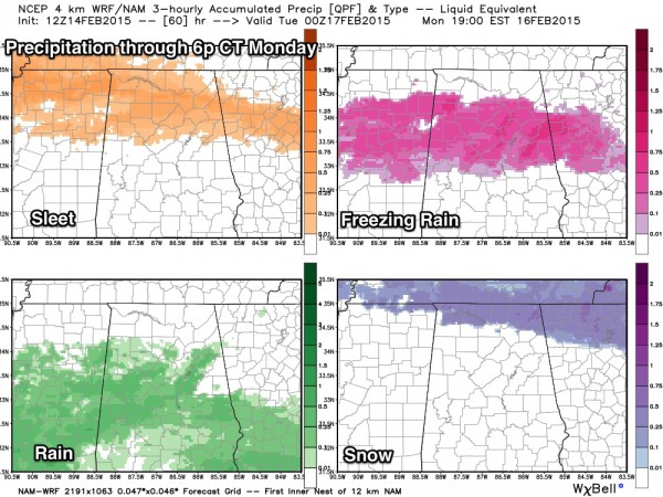
That is always a difficult question to answer during any winter storm, but I think this model graphic is on target… from the high resolution NAM model…
Mostly freezing rain/ice for Birmingham, Tuscaloosa, Birmingham, Gadsden… best chance of snow north of the Tennessee River. Icy/very dangerous travel possible after midnight tomorrow night into Monday north of a line from Aliceville to Centreville to Calera to Wedowee.
More later…
ALABAMA POWER IS READY, ARE YOU? Our friends at Alabama Power are monitoring the forecast closely, ready to deploy people and assets to quickly address any outages that might occur. Read a special message from Ike Piggot about their commitment to their customers.
Category: Alabama's Weather


