Late Morning Notes
The new 12Z model runs are in…
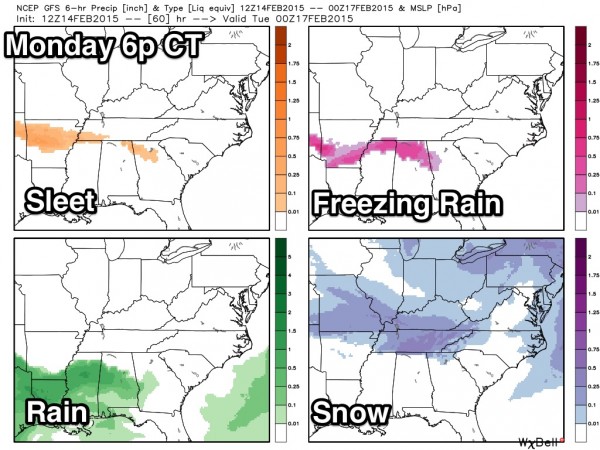
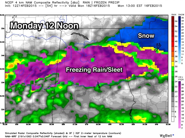
The trend is toward more freezing rain and sleet over North Alabama with less snow. But, understand this is just one set of model data, and you don’t make big changes.
GFS: You can see the trend toward more freezing rain…
NAM: Again, freezing rain and sleet is the headline…
If the 18Z set confirms this, we will move the snow band northward, toward far North Alabama, and stress freezing rain and sleet. Seems like the core risk of icing and dangerous travel will be along and north of a line from Aliceville to Brent to Calera to Wedowee at this point.
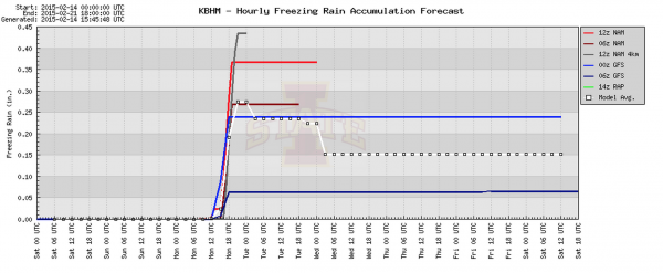
Data from the BUFKIT analysis tool shows potential for up to .35″ of ice accumulation… this is close to where some tree limbs could come down due to the weight of the ice, along with some potential for scattered power outages. You need about 0.50″ of ice for a major ice storm.
The main threat of freezing rain and sleet will come from about 3:00 a.m. until 3:00 p.m. Monday. A cold rain is likely Monday night with temperatures above freezing, with improving road conditions.
Be sure and scroll down for important notes on winter weather forecasting. We all know the skill set is limited, and there will be frequent forecast changes and adjustments as we get close to the event. Expect surprises.
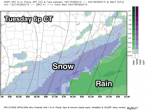
TUESDAY: The 12Z GFS still shows snow for parts of Alabama Tuesday… this run is more to the south.
We just can’t be specific about the Tuesday event with low forecast confidence.
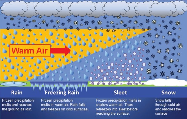
DO YOUR KNOW WINTER STORM PRECIPITATION TYPES? This helps explain…
ALABAMA POWER IS READY, ARE YOU? Our friends at Alabama Power are monitoring the forecast closely, ready to deploy people and assets to quickly address any outages that might occur. Read a special message from Ike Piggot about their commitment to their customers.
Stay tuned for frequent updates throughout the weekend.
Category: Alabama's Weather


