Sunday Evening Look At Tuesday’s Severe Weather Threat
Not much change in the overall thinking for the active weather expected Tuesday across Alabama. A vigorous weather system will bring the threat of heavy rain, and strong to severe thunderstorms.
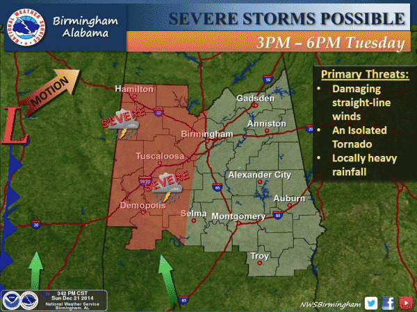
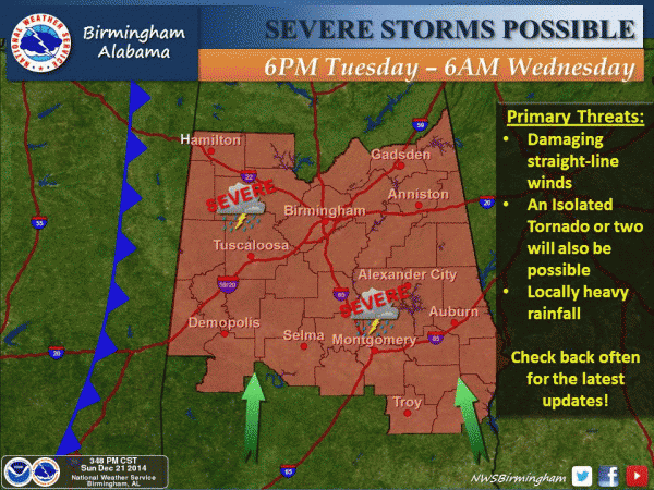
TIMING: Severe storms could impact West Alabama as early as 3:00 p.m. Tuesday; the core threat will come from 6:00 p.m. Tuesday through 3:00 a.m. Wednesday.
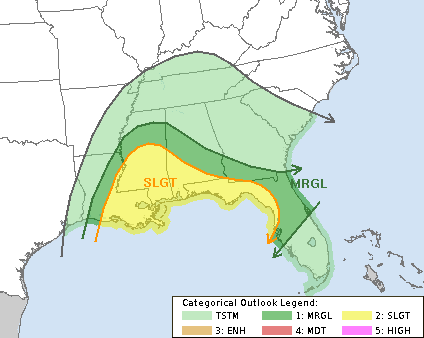
PLACEMENT: The best combination of shear and instability will come over the southern half of the state; SPC has the standard “slight risk” of severe weather up south of a line from Livingston to Greenville to Geneva, with a marginal risk as far north as Hamilton, Birmingham, and Auburn.
Remember, this outlook will probably change as get closer to Tuesday. The next outlook will be posted late tonight by the SPC, after the 00Z data set arrives.
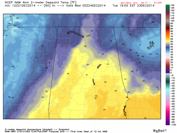
LIMITING FACTORS: For the northern half of the state, instability values are the key. If 60 plus degree dewpoints can advect up into North Alabama during the day Tuesday, then severe storms will be more likely. However, if morning showers are widespread, and if a thunderstorm complex forms along the Gulf Coast blocking good inflow, that will lessen the risk over North and Central Alabama.
Model data shows 60 degree dewpoints up to the I-20 corridor Tuesday evening at 6:00 p.m… which will roughly be the northward extent of the severe weather outbreak.
Severe weather is not expected north of U.S. 278 for now… or north of a line from Hamilton to Cullman to Gadsden.
MODES: Thunderstorms Tuesday afternoon and Tuesday night will be capable of producing hail, strong winds, and an isolated tornado or two.
Remember, this is not unusual for Christmas week; this is our late fall/early winter tornado season in Alabama. And again, please don’t buy into the national media/social media hype. This is not a “monster storm” that is “unprecedented’ with “millions in the path”. We just need to pay attention to the weather, and you need to have a way of hearing watches and warnings if needed.
I will have a full discussion and a new Weather Xtreme video by 7:00 a.m. tomorrow…
Category: Alabama's Weather


