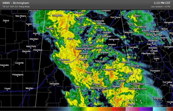
Rain/Storms Moving Northeastward
Well, as advertised rain and thunderstorms are pushing northeastward across much of Alabama on this Saturday afternoon.
Rain is overspreading the Birmingham Metro at this hour. But the storms are not severe.
So far there have been a couple of severe thunderstorm warnings in South Alabama and the NWS in Birmingham had to issue a tornado warning based on radar rotation for Barbour, Bullock and Pike Counties. No touchdown was reported and no tornado debris signature appeared on radar.
There is a tornado watch over Southeast Alabama where the best combination of instability and wind shear is present producing a threat for tornadoes.
Over Central Alabama, it is mainly just rain now with very little thunder. The support for the widespread rain (an upper level disturbance) is moving quickly northeast and is outrunning the instability that is lagging behind a bit. That’s good news, cause it means we may get out of this without any severe weather across Central Alabama.
To the south, the risk continues for areas south of a line from Atmore to Thomaston to Phenix City.
Category: Alabama's Weather, Severe Weather


