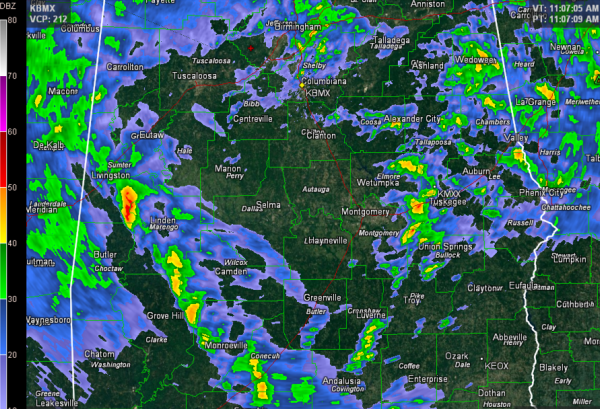
Watching Band of Storms Forming Over West Alabama
Showers and embedded thunderstorms are fairly widespread across North Central and East Central Alabama late this morning.
A band of storms over Southwest and South Alabama is the main concern for Central Alabama though as we head toward the afternoon hours.
That band extends from near Macon, MS to near Brewton in South Alabama. It appears to be a dryline feature and will serve to focus convection as it lifts northward. It should reach Tuscaloosa between 12:15-12:45 and Birmingham between 12:45 and 1:15.
The good news is that there is little if any surface based instability to provide fuel for the storms. But wind fields are strong, and any updrafts that do become surface based will have the potential to produce damaging winds. Further southeast, over Southeast Alabama into southwestern Georgia, there is more instability and conditions are favorable for a few tornadoes. The SPC is considering issuing a tornado watch for those areas.
The band of storms will continue to lift northward. Some of the storms might become severe, but we don’t expect many warnings across Central Alabama this afternoon. We will be watching conditions closely though in case they change.
Category: Alabama's Weather, Severe Weather


