Hello Gonzo! Well, Actually Gonzalo…
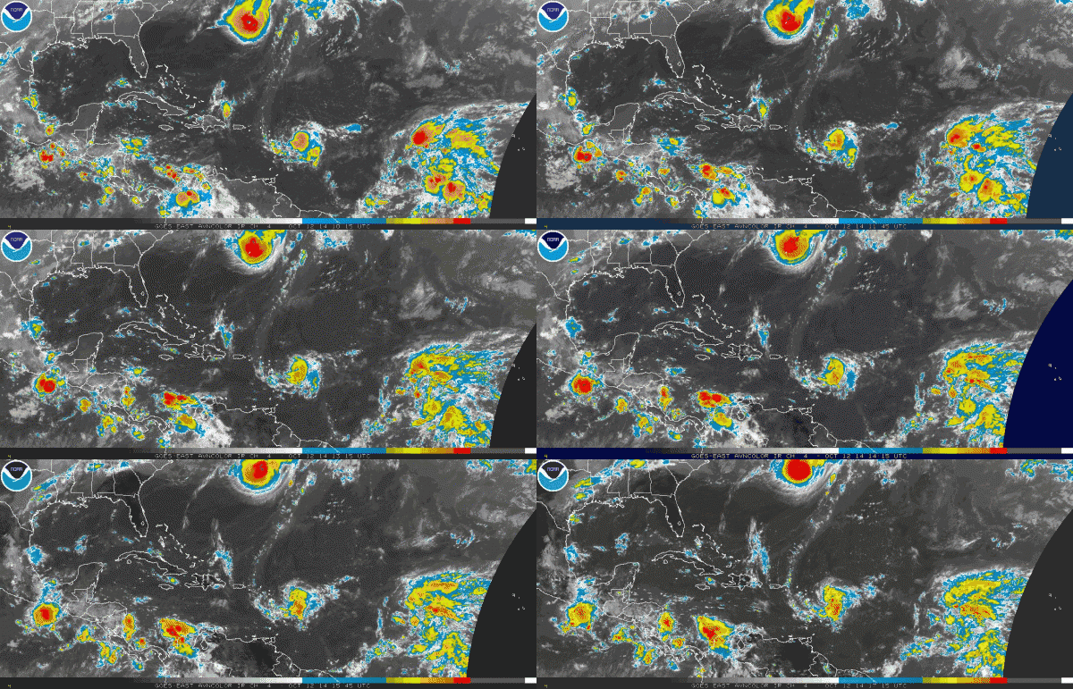
We have experienced a little burst of activity in the tropical Atlantic as a cycle called the Madden Julian Oscillation (MJO) is bringing favorable conditions to much of the basin.
Tropical Storm Fay scored a direct hit on the island of Bermuda overnight. Winds officially gusted to 82 mph as the 70 mph tropical storm passed just east of the island after midnight last night. Winds dropped to near calm as the center passed and the barometer was measured at 986 mb. It will continue to the east northeast over open ocean over the next few days.
Now comes Gonzalo…
Based on Air Force Reconnaissance reports from the disturbance east of the northern Leewards, the National Hurricane Center is now issuing advisories on newly formed Tropical Storm Gonzalo. Gonzalo will produce tropical storm conditions across the northern Leewards, Virgin Islands and perhaps Puerto Rico. The system will recurve to the north.
Here is the latest info on Gonzalo:
SUMMARY OF 130 PM AST…1730 UTC…INFORMATION
———————————————-
LOCATION…16.4N 58.4W
ABOUT 200 MI…320 KM E OF GUADELOUPE
ABOUT 230 MI…370 KM ESE OF ANTIGUA
MAXIMUM SUSTAINED WINDS…40 MPH…65 KM/H
PRESENT MOVEMENT…W OR 270 DEGREES AT 10 MPH…17 KM/H
MINIMUM CENTRAL PRESSURE…1009 MB…29.80 INCHES
Here is the summary of watches and warnings:
A TROPICAL STORM WARNING IS IN EFFECT FOR…
* GUADELOUPE
* DESIRADE
* LES SAINTES
* MARIE GALANTE
* ST.MARTIN
* ST. BARTHELEMY
* ST.MAARTIN
* SABA
* ST. EUSTATIUS
* BARBUDA
* ANTIGUA
* ANGUILLA
* ST. KITTS
* NEVIS
* MONTSERRAT
A TROPICAL STORM WATCH IS IN EFFECT FOR…
* PUERTO RICO
* VIEQUES
* CULEBRA
* U.S. VIRGIN ISLANDS
* BRITISH VIRGIN ISLANDS
Further east, Hanna is likely to form in coming days as well, but will recurve well to the east of the islands.
Category: Tropical


