Severe Storms Possible Tomorrow Night
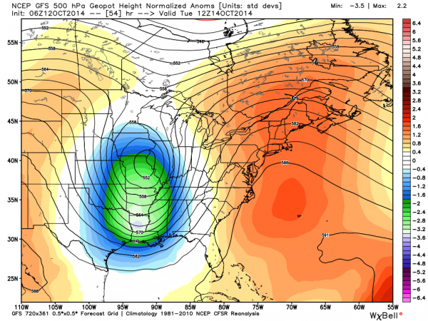
Here is a look at the Alabama severe weather situation Monday night. A strong upper trough will approach from the west, providing very good dynamic support for the attendant cold front.
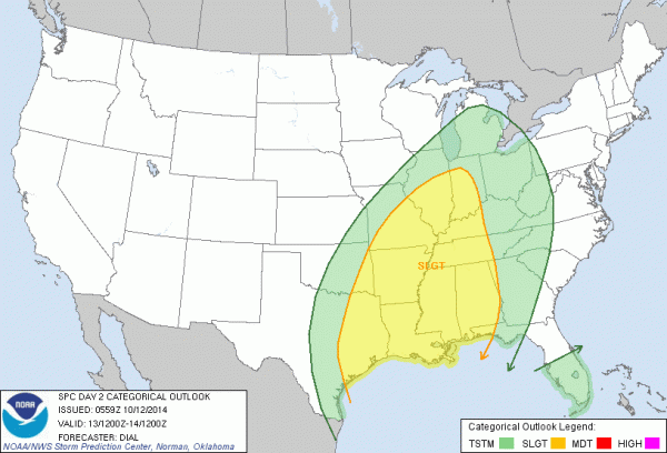
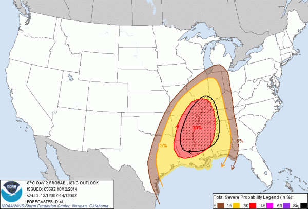
The Storm Prediction Center has almost all of Alabama in the standard severe weather “slight risk” for tomorrow night, with higher probabilities over the far western part of the state.
Forecast surface based instabilities are not especially impressive, with CAPE (convective available potential energy) values generally under 1,000 j/kg. The one parameter that does stand out is the low level jet (the winds near 5,000 feet off the ground), which will exceed 50 knots over the northern half of the state.
TIMING: While scattered storms could break out tomorrow afternoon, the core severe weather threat will come from roughly 6:00 p.m. tomorrow through 3:00 a.m. Tuesday. Approximate timing for the main line of storms…
West Alabama: 8pm to 11pm
I-65 Corridor/Central Alabama: 11pm to 3am
East Alabama: 3am to 6am (storms should be slowly weakening at this time)
THREATS: The primary threat will come from damaging straight line winds within the QLCS, or squall line. However, there will be sufficient bulk shear for a few small, short lived embedded tornadoes within the line. Thunderstorm winds could be sufficient to knock down trees and power lines during the night. Rain amounts should average 1/2 to 1 inch, but that won’t be enough to create signifiant flooding issues, most likely.
CALL TO ACTION: Since this will be a late night/pre-dawn event, everyone will need to have a properly programmed weather radio, with good batteries installed in case of a power outage, available in your home so you won’t miss any warning that is issued. And, of course, good smart phone apps are another great way of receiving warnings. Apps like WeatherRadio, and MyWarn work very well.
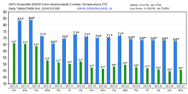
AFTER THE STORMS: Much cooler air invades Alabama; highs drop into the 60s Wednesday, and lows will be in the upper 40s and low 50s…
Brian Peters will have a full weather discussion, and a new Weather Xtreme video shortly. Stay tuned…
Category: Alabama's Weather


