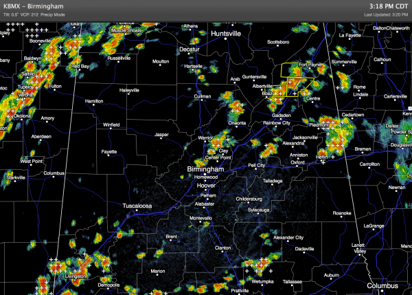
Big Summer Storms
An all new edition of the ABC 33/40 Weather Xtreme video is available in the player on the right sidebar of the blog. You can subscribe to the Weather Xtreme video on iTunes by clicking here.
STRONG TO SEVERE STORMS: Another day with very big summer thunderstorms across Alabama in scattered spots. A number of severe thunderstorm warnings have been required for North Alabama counties due to the potential for wet microbursts again today (localized areas of damaging straight line winds).
Storms are moving east/northeast, and all of them are producing lots of lightning, heavy rain, and gusty winds. They will slowly calm down late tonight.
THE ALABAMA WEEKEND: Moist, unstable air stays in place, and with a wavy, zonal flow the risk of showers and thunderstorms will continue. We will forecast scattered to numerous showers and thunderstorms tomorrow and Sunday; the best chance of rain will come during the afternoon and evening hours, but we can’t rule out a late night or morning shower. And, like today, some of the storms will be strong with gusty winds and lots of lightning. Highs for the weekend will be in the 88-92 degree range with a limited amount of sunshine both days.
NEXT WEEK: The chance of showers and storms will continue Monday and Tuesday, but the GFS continues to hint at drier air moving into North Alabama Wednesday thanks to an upper trough over the eastern third of the nation. This would mean lower humidity and cooler nights over the latter half of next week; we might make a run at lows down around 60 degrees early Thursday and Friday morning, with potential for upper 50s across the cooler valleys. Maybe even close to record lows again. See the Weather Xtreme video for the maps, graphics, and details.
GULF COAST WEATHER: About 6 to 8 hours of sunshine each day through early next week from Panama City over to Gulf Shores, with the usual risk of scattered showers and thunderstorms. Highs in the upper 80s on the immediate coast, with sea water temperatures mostly in the mid 80s.
TROPICS: The Atlantic basin remains very quiet, and tropical storm formation is not expected through early next week. The Pacific remains active; Tropical Storm Iselle is fading fast over Hawaii, but it did produce very heavy rain, some flooding, and tree and power line damage. Hurricane Julio will weaken and pass well north of the Hawaiian Islands this weekend.
WEATHER BRAINS: Don’t forget you can listen to our weekly 90 minute netcast anytime on the web, or on iTunes. This is the show all about weather featuring many familiar voices, including our meteorologists here at ABC 33/40.
CONNECT: You can find me on all of the major social networks…
Facebook
Twitter
Google Plus
Instagram
My next Weather Xtreme video will be posted bright and early Monday morning by 7:00… Brian Peters will have the video updates tomorrow and Sunday. Enjoy the weekend!
Category: Alabama's Weather


