Notes on Arthur
I will keep some notes going today on here about Arthur, updating them at the top of the post until the next advisory comes out.
AT 10 AM CDT
———————————————–
LOCATION…29.1N 79.1W
ABOUT 105 MI…165 KM ENE OF CAPE CANAVERAL FLORIDA
ABOUT 260 MI…420 KM SSE OF CHARLESTON SOUTH CAROLINA
MAXIMUM SUSTAINED WINDS…60 MPH…95 KM/H
PRESENT MOVEMENT…N OR 360 DEGREES AT 7 MPH…11 KM/H
MINIMUM CENTRAL PRESSURE…997 MB…29.44 INCHES
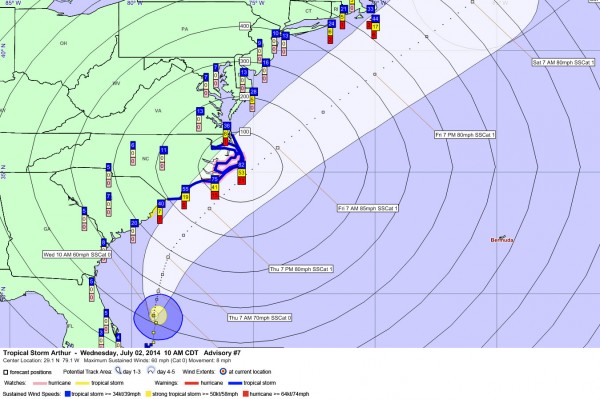
As you can see from the updated graphic, tropical storm warnings have now been issued for the entire North Carolina coast.
There is still a tropical storm watch for a portion of the South Carolina coast.
There is a hurricane watch for the Outer Banks.
There are numerous tropical storm warnings in effect for the coastal waters offshore.
The official forecast track has been nudged slightly east but brings the center within 50 miles of Cape Hatteras during the pre-dawn hours Friday.
The wind probabilities are about the same as late last night, except they have increased slightly on the Outer Banks for tropical storm force winds, around 75-80%.
SATELLITE
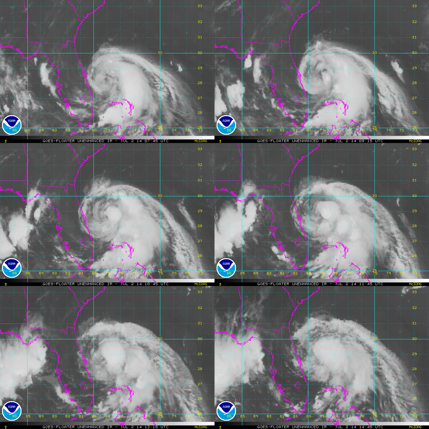
The storm ingested a little dry air last night and took a hit in appearance, but it appears to be moistening again this morning. Tropical cyclones are like little steam engines, puffing up and down as thunderstorms develop and mature. Arthur is starting to look stronger on satellite.
INTENSITY
Arthur is forecast to become a hurricane tomorrow and should peak at around 85 mph in intensity before it starts to weaken and lose tropical characteristics as it races northeast ahead of the approaching trough, moving over colder water.
RECON
No planes in the storm right now, but there are two low level missions that will reconnoiter the storm all day and night starting around noon. There are also three NOAA flights scheduled, including a high altitude flight for this evening.
Category: Tropical


