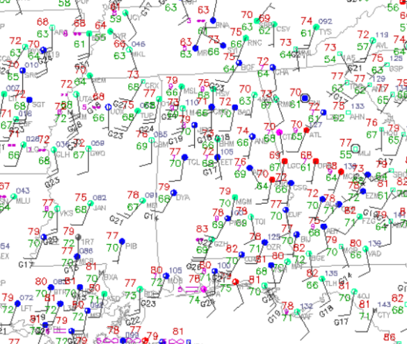
Quick Look at the Surface Observations around the Region
Very warm temperatures across the Southeast today, even with all the cloud cover in place. Dew points are rising as well and most locations across the state are seeing dew points in the upper 60s. Tuscaloosa’s dew point it now up to 70. The dew points will continue to rise today as the southerly winds continue to bring in warm, and moist air form the Gulf of Mexico.
With some break in the clouds and increasing dew points, instability is increasing across the area. This is not good as this will also enhance the severe weather threat over the state today. Such high dew points will provide plenty of fuel for thunderstorms today. Over the next few hours, we should begin to see storms developing to out west. Plan now for the onset of strong and severe storms later this afternoon and evening. These storms will have very large hail, damaging winds, tornadoes, and the threat of flash flooding.
Category: Alabama's Weather, Severe Weather


