Late Night Look
RIGHT NOW: Most of Alabama is rain-free and there are no severe storms threatening the state.
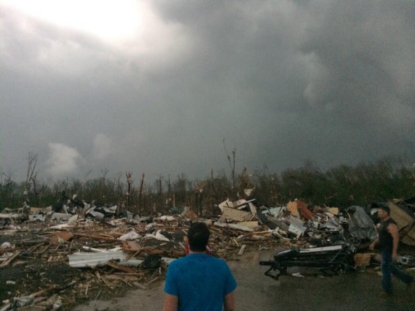
A tragedy is unfolding over Arkansas where a violent tornado moved through Mayflower and Vilonia tonight. Damage looks severe.
We do not expect any thunderstorm problems through at least 4:00 a.m.
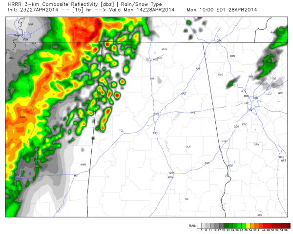
The HRRR high resolution model does show thunderstorms moving into Northwest Alabama early tomorrow morning. This is the output valid at 9:00 a.m. CT
These storms could possibly be severe, especially over Northwest Alabama, with a marginal tornado threat. They will need to me monitored closely.
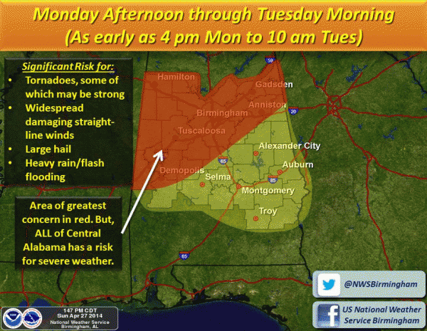
However, the main threat comes later in the day, from roughly 4:00 p.m. tomorrow through Tuesday morning.
All modes of severe weather will be possible during the time, including a few tornadoes.
There is also potential for another round of severe storms Tuesday afternoon or Tuesday night, but it remains to be seen if the air can sufficiently destabilize for this to happen.
NO NEED TO PANIC: Severe weather threats like this are very common in April in Alabama. There is absolutely no need to be alarmed; just have a good way of getting severe weather warnings, know the safe place in your home or business, and have a readiness kit, and you will be just fine in case there is a tornado nearby. Go here for more on “having a plan”.
SCHOOLS: Go here to see the schools that are closing early tomorrow.
WEATHER RADIO HELP? We have put together this video to make it easy for you to program a Midland NOAA Weather Radio.
APPS: Don’t forget you can watch our live tornado coverage on any of the ABC 33/40 apps, and the James Spann 24/7 app. See how to find them here.
For receiving severe weather warnings on your phone, we like MyWarn or iMap WeatherRadio.
CONNECT: You can find me on all of the major social networks…
Facebook
Twitter
Google Plus
Instagram
Will have a fresh discussion here very early tomorrow along with a new Weather Xtreme video…
Category: Alabama's Weather


