Morning Update
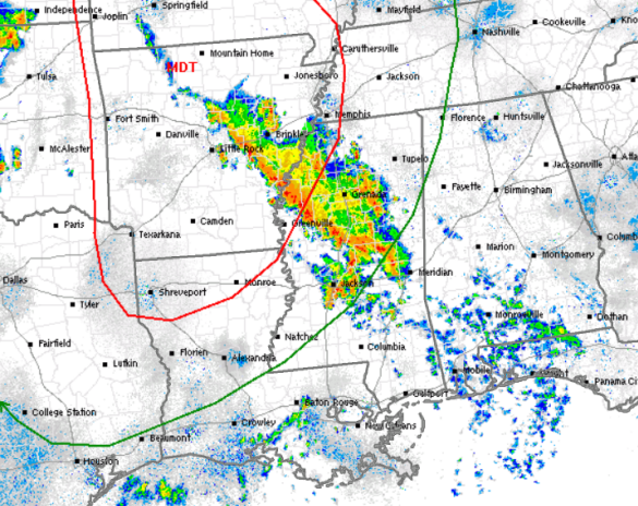
Showers and storms are working north across Mississippi this morning and these are associated with a warm front that is lifting north ahead of the storm system to our west. There have been a few isolated severe storms embedded within this line, with a few damaging winds gusts and some hail. This activity will continue to lift towards the north and east today and we will see some scattered showers and storms across Alabama later this morning.
Widespread severe weather is not expected today across the state. The SPC has the extreme northwestern corner of the state included in the slight risk, but this is for activity that will arrive early tomorrow morning. Later today, widespread and organized severe weather will be developing to our west and will be heading east through the evening and overnight hours. It should move into northwestern portions of Alabama early tomorrow morning, with the threat of gusty winds, hail, and isolated tornadoes. These storms will be weakening as they enter the state, as they outrun the better dynamics. Tomorrow is when things get very interesting and much of the state will see severe weather.
Category: Alabama's Weather, Severe Weather
About the Author (Author Profile)
Macon, Georgia Television Chief Meteorologist, Birmingham native, and long time Contributor on AlabamaWX. Stormchaser. I did not choose Weather, it chose Me. College Football Fanatic. @Ryan_StinnetSubscribe
If you enjoyed this article, subscribe to receive more just like it.


