Snow Here, Tornado Warnings in Florida!
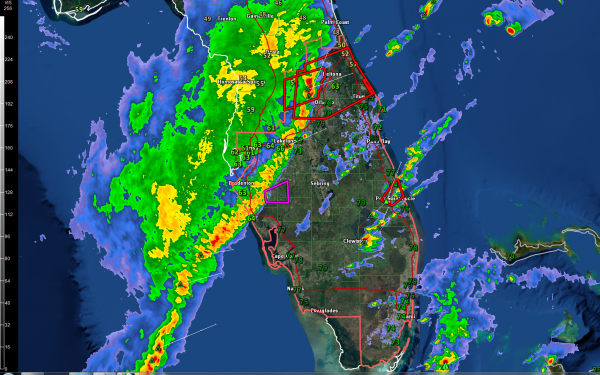
To show you the dynamic nature of this powerful winter storm, there is now a severe thunderstorm watch, two severe thunderstorm warnings and a tornado warning in Florida.
Please click on the images to enlarge them.
Here is the latest composite radar from GREarth with temperatures, the watch and the warnings.
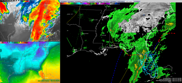
Here is a SimuAWIPS image focusing on three ways to look at the storm:
…In the large panel, you can see the composite radar of the Southeast with the frontal positions and the surface low near Panama City. The severe thunderstorm watch is highlighted in blue. The low has been strengthening rapidly and now has a minimum pressure of 1005 mb. By the time it reaches New England Friday morning, it should be down in the 973 mb range.
…In the top left panel, there is an enhanced infrared satellite image showing very cold cloud tops in bright colors.
…In the low left panel you can see the dramatic temperature contrast around the storm system.
Category: Alabama's Weather, Severe Weather, Winter Weather


