The Snow is Moving Out of the State
The last of the snow is moving out of the state this evening. It was an exciting day across Central Alabama as snow moved into Alabama from Mississippi during the early afternoon. The heavier snow fell across our southwestern counties where there were quite a few pics sent in via social media of grassy areas and elevated surfaces covered by snow, but no weather related travel problems were reported.
Snow flurries and showers were reported across much of the northern half of the state, including Birmingham, Tuscaloosa, and Gadsden. To the south, warmer air in the upper-levels allowed the snow to melt and after refreezing, caused mostly sleet south of U.S. 80 and around Auburn, Montgomery, and Troy. There is still a bit of precip falling across our southeastern counties, but by 7 or 8 PM this evening, most of the state should be clear of the precip.
For the rest of tonight, what precip is left will be very light and will dissipate. We will begin to see our skies clear and we will see partly cloudy skies by tomorrow morning. Everything will be back to normal tomorrow.
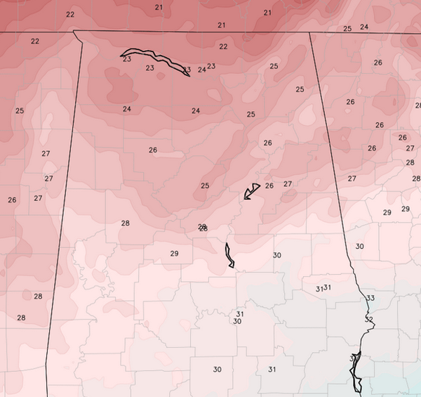
We will have a cold night as lows will be back into the 20s. As we look at the NAM forecast temperatures for tomorrow morning, the graphic below shows mid to upper 20s should be widespread across Central Alabama. These values seem fairly reasonable, but with the clouds in place, temps could be a few degrees warmer. These values aren’t too bad, and are certainly much better than we have seen this winter.
Category: Alabama's Weather, Winter Weather


