Review Of The Jan 28 Alabama Snow Event
Birmingham received 2.0 inches of snow on Tuesday, January 28, 2014. Other snow amounts across North-Central Alabama varied generally from 0.5″ to 3.0″. For most places over the northern U.S., this is nothing but another winter day; people wouldn’t even notice it. Around here, it was a nightmare for some.
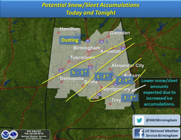
FORECAST BUST: On a synoptic scale, the forecast was good. An overrunning snow event for Alabama, with significant accumulation for some. On the mesoscale, the forecast was a disaster since there was a displacement of the heavier snow band on the northern end. This put down accumulating snow over larger cites like Birmingham, Tuscaloosa, Anniston, and Gadsden. Cities where a “dusting” was forecast. The “dusting” bust will live long in Alabama weather history. Here is the National Weather Service forecast, issued at 5:35 a.m.
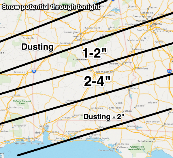
And, the forecast graphic I prepared at about the same time the morning of January 28…
You can see the small scale nature of the forecast miss. If the northern boundary of that 1-2″ zone was pulled about 40 miles to the north, the situation would have been covered. It is unfortunate that those 40 miles just happened to represent the most populated part of Alabama.
In coming weeks and months, we will look at the reasons for the spacial forecast error. But I don’t know with our current skill set forecasts will improve much with winter weather situations in Alabama. Missing a northern 1-2 inch zone by 40 miles, quite frankly, isn’t very unusual… we just need to communicate uncertainty better.
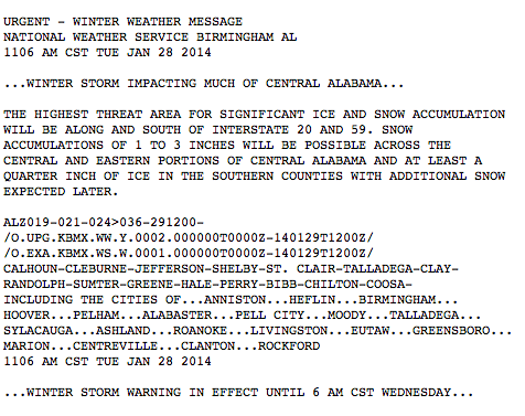
SEQUENCE OF EVENTS: I honestly didn’t recognize the forecast error until 8:30-9:00 a.m. I was going about my business, and was headed to Northside Middle School in northern Tuscaloosa County for a weather program. I pulled over at the I-59/20 rest area near Brookwood, and after a review of data and reports, no doubt things were going wrong. After posting updates on social media, I turned around and headed back. Thankfully I made it Riverchase Parkway in Hoover before getting into gridlock. I walked the final mile to ABC 33/40 after abandoning the car. The National Weather Service finally issued a winter storm warning for Birmingham, Tuscaloosa, Anniston, and Gadsden at 11:06 a.m.
CIVIL EMERGENCY: Even if I had the northern boundary of the 1-2 inch snow zone pulled 40 miles to the north, I would have not expected the impact on Alabama.
Once it was apparent that snow was accumulating more than forecast in the larger cities, schools and businesses closed, and everybody tried to get home, all at once.
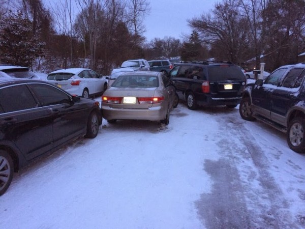
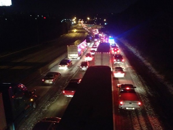
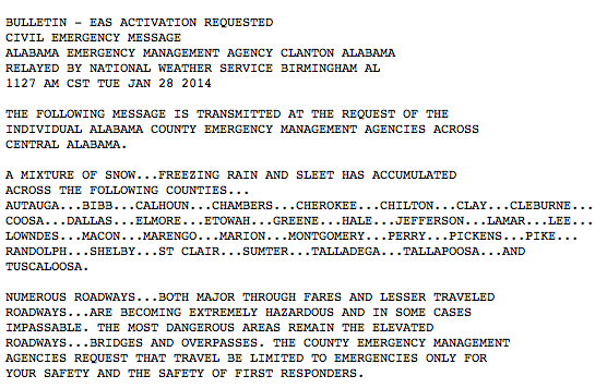
And, the 1-2 inches of snow basically produced travel conditions you would expect from a crippling ice storm (a long duration of freezing rain). Travel went from difficult to impossible, cars were left in the middle of highways as people changed from a “get home” mindset to a “survive” mindset. Thousands of kids were stranded in schools, countless adults spent the night in their office, some spent over 20 hours stuck in their vehicle on Interstate highways. Families were separated, and this developed into a full blown civil emergency; a humanitarian disaster. A Civil Emergency Message was issued by the NWS at the request of EMA at 11:27 a.m.
CIVIL EMERGENCY WITH TWO INCHES OF SNOW? That is a question so many of are asking. Clearly the key parameter was the surface temperature, in the 18-22 degree range. It is very rare for snow to fall in Alabama with temperatures this low. A friend who works at the National Weather Service in Lubbock, Texas, writes…
“Even out here in Amarillo we typically get our worst travel problems and most accidents with 1-2 inches of snow. It actually seems like we have more problems with the dry, powdery snows than the wet, slushy snows. Just from my short experience out here, air temperatures of 28 F and lower seem to be when snow and ice accretion really start developing quickly on the roads.”
I will clearly tell you next time we expect 1 to 2 inches of snow with temperatures under 25 degrees (F), we will ramp up the forecast potential for travel disruption in a big way. Studies need to be done on the accretion process the morning of January 28, why so much ice was involved on roads with a powdery snow.
IMPACT FORECASTING: We are in the business of forecasting weather; we need to learn a better way of forecasting, and communicating the actual impact of weather events. Social scientists and emergency managers can help us, and we will be calling on them to make “impact forecasting” better. Not sure anyone could have called the impact of this specific event, even if the weather forecast was correct (with 1 to 2 inches of snow), but we still must learn and be better.
CREDIBILITY HIT: As should be the case, there was quick reaction to the bad forecast.
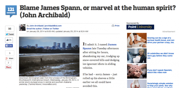
After a sleepless night, I wrote this apology the morning of January 29.
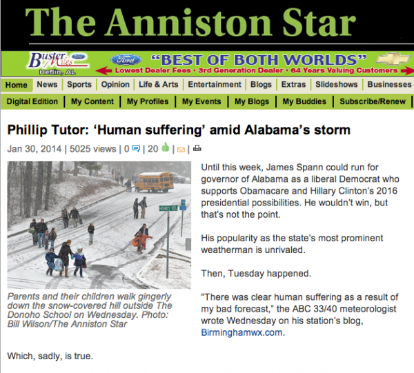
It was mentioned in the New York Times later in the day…
Forecast busts are part of what we do. Any human who forecasts weather will make errors. Like ours on January 28; even the mesoscale, 40 mile errors can be a disaster. The last time there was a forecast error with such human impact was in January 1982, when a timing error put the city in the same situation. The main difference in 1982 was that it was primarily a freezing rain event, and the shut down lasted longer.
If you can’t handle the heat, you don’t need to be in this job. I tell young people, if you do a good job with a severe weather event and get lots of praise, or nail a very difficult forecast, don’t get a big head. Keep a “hate mail” folder on your email program and cruise over there if you think you are something special. That nasty mail will bring you back to reality. On the other hand, if you miss a high impact forecast, go back to the kind emails you get during getter times so you won’t feel so bad.
By nature, a meteorologist has to have a very thick skin. Most all of the criticism I received in recent days is valid. People need to vent, and they need to vent at me. The extreme haters on social media will move on to the guy in the next big news story next week; they don’t bother me. Constructive criticism is one thing, pure hate, anger, and rage is another.
The big issue is that we need to rebuild lost credibility. We only do this by cranking out good, accurate products. And, resist the temptation to “hype up” every forecast with doom and gloom to keep us out of trouble. Constantly pushing the worst case scenario leads to the “cry wolf” syndrome, and is good for nothing. Bottom line is that we can’t let a forecast bust “get into our head”
SO MANY WEATHER SOURCES: I have spent much this day (Feb 2) putting down rumors of “two foot snowstorms” and other extreme events people are hearing about on blogs and social media. The latest trend is for the armchair mets to find computer model graphics that are extreme and post them across social media. Some of the graphics are valid 7 to 15 days way. The truth is that there is very little skill in a specific forecast beyond seven days. You can use pattern recognition, and look for model consistency. But, no real skill.
Yes, I show model output beyond seven days during deterministic and ensemble output on my daily Weather Xtreme videos, which I have been producing every weekday for the past 10 years. But, I clearly state the model output in the medium range (days 7-15) as “voodoo”. We are just looking for trends, and watching teleconnections. Long time blog readers and users of my products totally understand this.
I produce those videos year round, not just when the weather is “sexy” with some chance of snow, or severe weather.
I actually don’t mind the “armchair meteorologists”… all of us working professionally used to be one when we were kids. The problem comes when they give inaccurate information that confuses the public, and information that can become dangerous. Like forecasting a “April 27” type tornado outbreak, when in truth the actual severe weather threat is marginal. And, since we all have social media accounts, we can push our forecasts to the world, and they can go viral if you make them extreme enough.
And, the armchair people generally have no understanding of the physics, resolution, or biases of the “models” they post. They are just looking for the pretty blue colors that show a big snow, or red colors that hint at big storms. The earth’s atmosphere is complicated, and chaotic. Forecasting the weather is much more than NWP (numerical weather prediction).
But the problem we are seeing today is mostly due to the missed January 28 forecast. It will take some time to repair the damage done to our reputation (the professional weather enterprise). Totally our fault, but we must press on. You ultimately have the choice of using products like our weather blog, or some “model map” somebody posted on a Facebook wall. I hope you consider our products and services over social media hype. I will write more bad forecasts in the future (that is why it is called a forecast), but I assure you the best science knowledge available and long years of experience is put to good use in our products.?
BOTTOM LINE: We will have an IWT (Integrated Warning Team) meeting in the near future with the National Weather Service, broadcast meteorologists, and emergency managers as we begin to review January 28. As a weather enterprise, we must use mistakes to get stronger, smarter and better.
THE GOOD THING: Over and over the stories of human kindness and compassion are being told. I have literally hundreds and hundreds of these kinds of messages…
“To Whom it May Concern: I know you have probably been bombarded by emails, phone calls, etc. about miraculous stories from the snow storm that hit our city, but I would like to let you know of one more. It may sound dramatic, but I would have died had the Splawn Family not picked me up on the side of the road. I was forced to abandon my car in a Hoover neighborhood and began walking to a friends house. Little did I know it was all up hill and I would eventually fall and hurt my leg that it made it incredibly hard to walk. As it began to get dark outside, I was frozen from head to toe, trying my best to get to my friend’s house, only to feel so defeated and scared that I was going to die.
The Splawn family had left the comfort of their home (where they were all together) to brave the elements to take pillows, blankets, and toothbrushes to a local elementary school. Had that family not given selflessly of themselves to others, they would have never seen me walking on up that hill. They picked me up, no questions asked, and let me stay the night with them. Was it crazy to get in the car with a stranger? Sure, but I was desperate. I would have died without that family – they were a true miracle. If they could be recognized in some way, I would be so grateful. Thank you so much in advance”
I am so proud of the people of Alabama and their response to the winter storm. I was born here, and I plan to die here. Being southern born and southern bred is a blessing sometimes I don’t appreciate. Thanks to all of you for your support.
Category: Alabama's Weather

