Watching the Radar
The radar is certainly beginning to fill in across Alabama this morning. The air over Alabama remains very dry, some of the returns you are seeing from the radar could be a bit misleading. However, as the event continues, we will see the atmosphere over the state to continue to saturate.
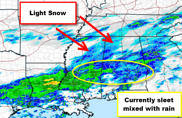
Currently we are seeing light snow over northern Mississippi and into northwestern Alabama. Reports via social media of snow falling in Haleyville, Fayette, and Hackleberg, with a light dusting in a few areas already. These snow bands will continue to move east and we will likely begin to see snow reported in Tuscaloosa, Birmingham, Cullman, Gasden, and Anniston within the next couple of hours.
To the south, where some of the more intense radar returns are, we are seeing a rain/sleet mixture. Throughout the morning we will begin to see all precip along and north of U.S. 80 begin to transition to all snow. Our forecast remains the same, with the heavier accumulations to the south along U.S. 80 and Interstate 85, but snow is expected across much of the state today.
The wintry precip is expected to fall most of the day across the state, road conditions across North-Central Alabama are expected to remain ok, while to the south, impacts on travel are expected.
Category: Alabama's Weather, Winter Weather


