A Review Of Tonight’s Storm Potential
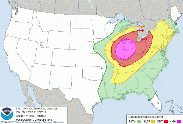
Before we discuss the Alabama weather situation, let’s first off point out that a major severe weather event is expected later today and tonight over parts of the Midwest…
If have relatives in the moderate/high risk area, be sure and let them know of the risk and be sure they are in a position to hear severe weather watches and warnings as they are issued. Having a “siren mentality” in this kind of outbreak is very dangerous, you need a NOAA Weather Radio and a good smart phone app like MyWarn or iMap WeatherRadio as your two sources of warnings.
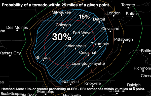
A few long track, violent tornadoes are possible over states like Illinois, and Indiana later today in that high risk zone. There will also be many reports of damaging winds. Below is a closer look at the tornado probabilities…
FALL SEASON: Just a reminder, this is the core of the fall tornado season in Alabama. Having severe weather issues this time of the year is not unusual, and is to be expected. It is an anomaly to have the risk so far north.
DOWN OUR WAY: During the day today a few scattered showers are possible; maybe even a thunderstorm in spots this afternoon. But, the main risk of organized storms will come tonight.
SPC has actually reduced the size of the “slight risk” of severe weather for North Alabama, which is a good call. The risk of north of a line from Reform to Blount Springs to Fort Payne, and does not include Birmingham, Tuscaloosa, Anniston, or Gadsden.
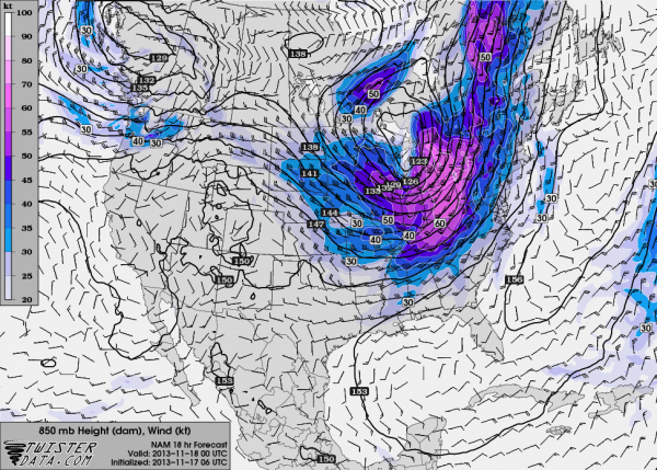
Below is the forecast 850 mb wind profile (about 5,000 feet off the ground) at 6:00 CT this evening…
Clearly, the stronger wind fields and dynamics will pass well north of Alabama, which will generally keep us out of “big trouble”.
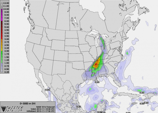
However, dew points are expected to surge into the upper 60s today, giving the air a “tornado feel”, and making instability values rise through the day. A line of storms will develop northwest of Alabama, and they would be severe through North Mississippi and West Tennessee. Below is the forecast 0 to 3 km EHI (energy helicity index) at 6:00 p.m. CT, which defines the risk at that time pretty well…
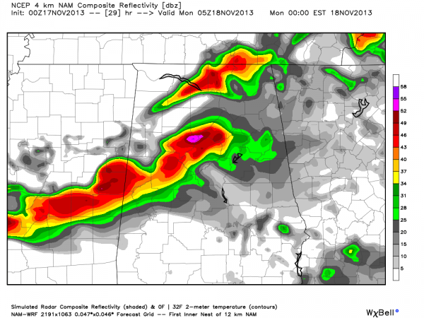
A severe storm is possible within the line as it moves into Alabama in the 6:00 to 8:00 p.m. time frame, but they storms should weaken as they move deeper into Alabama as the dynamic support pulls away and the air becomes more stable after dark. Storms will be in the Birmingham/Tuscaloosa/Anniston/Gadsden area sometime between 10:00 p.m. and Midnight; below is the high resolution NAM output valid at 11:00 p.m.
There is a very good chance the storms will be well under severe limits by the time they reach the I-59/20 corridor.
BOTTOM LINE: A few severe storms, with potential for strong gusty winds, are possible over Northwest Alabama early tonight, but they should weaken as they move southeast, and the severe weather threat for our part of the state is very marginal. But remember, when it comes to thunderstorms expected the unexpected, so we will be watching trends closely during the day.
Category: Alabama's Weather


