Clouds, Showers Nearby. And a Look at the Tropics.
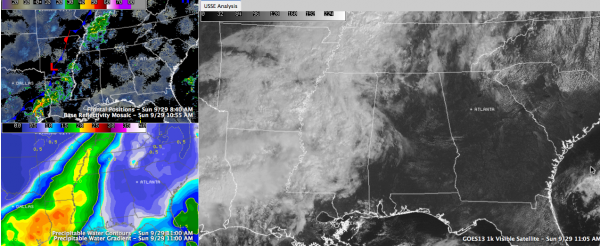
There is a frontal system to our northwest this morning. It is only making grudging progress to the southeast, but its advance guard has edged into Northwest and West Alabama. The clouds have had a hard time of it as the dry airmass over Alabama has tended to evaporate them. You can see the clouds on the right panel of this SimuAWIPS graphic and the drier air on the lower left panel:
Scattered showers are lined up along the front, which lies near Little Rock. There are some storms over northeastern Texas. All of that is in the top left panel of the graphic.
The front that you can see on the radar image may make Memphis by dark, but it will die a slow death on Monday as it tries to work into northern Mississippi. With the front in close proximity, we will maintain a low end chance of showers over North and West Alabama this afternoon, edging a little southeastward during the evening and overnight. The shower chances will continue into Monday afternoon. Still, the chance that you will get wet is less than one in five. Highs today will be around 80F, and maybe a degree or two warmer Monday.
MIDWEEK PROGNOSIS: Since the front won’t push through the area, the regime won’t change. In fact, the moister side of the regime will call for reinforcements and high pressure to our east will comply, pumping in increasing humidity through midweek. There will be a chance of a few showers and storms getting going mainly during the afternoon and evening hours in the Tuesday through Thursday time frame. It will continue to be warm, with highs in the lower to middle 80s each afternoon. Lows will be in the middle 60s.
END OF THE WEEK/WEEKEND: A stronger trough and accompanying frontal system will push into the Southeast in time for the weekend. Timing is still fuzzy, but a round of rain and storms will likely affect the area between Friday night and Saturday night. So somewhere in there, we will deal with 2-4 hours of rainfall. While we could use the rain, it could impact activities like football games.
EYE ON THE TROPICS: Tropical Depression Eleven formed overnight in the mid-Atlantic, but is no threat to any land areas as it will become a tropical storm (named Jerry) wandering in the oceanic wilderness about 1,000 miles east southeast of Bermuda.
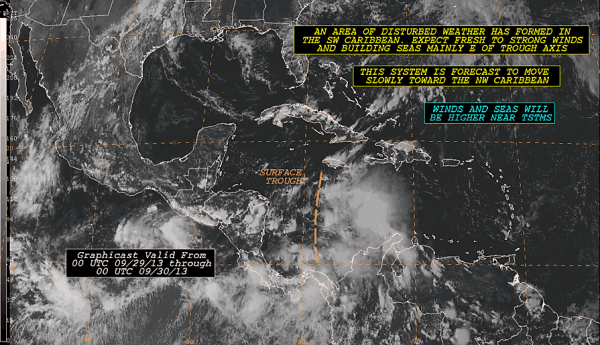
97L OF MORE INTEREST: The NHC has officially designated the trough of low pressure over the Central Caribbean as Disturbance 97L. The system is moving slowly northwestward. There is a pretty good chance that we will see a tropical cyclone develop over the northwestern Caribbean Tuesday or Wednesday. The system will move into the Gulf of Mexico, but it will encounter increasingly hostile conditions from our approaching weekend frontal system and it should be of little consequence for the Gulf Coastal states. But the moisture could still produce copious amounts of tropical rains for someone, most likely southern Florida.
Category: Alabama's Weather


