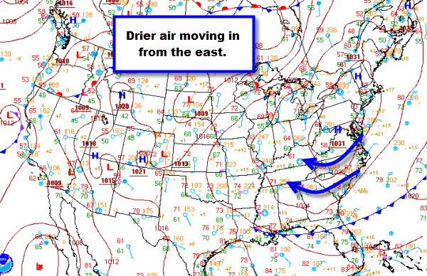
Drier Air Flowing into Alabama
Finally some relief from the persistent showers and storms we have seen all summer. We may actually make it 5-7 days before most areas will see a chance of rain again.
Dry air is filtering in to the state thanks to the area of high pressure in the Mid-Atlantic. This area of high pressure will be building into the Southeast the next several days. The clockwise flow around the high means our winds are from the east and easterly flow is typically drier. This easterly flow will continue to usher in this drier air for most of this week.
Dew points will be coming down and should settle into the upper 50s and lower 60s. Even though afternoon highs will still be very warm, upper 80s and lower 90s, the lower dew points will make it feel less uncomfortable during the heat of the day. Overnight lows will be very nice. Lower-to-mid 60s for most areas, with even some 50s expected across northern portions of the state. Not a bad way to end the month of August.
Category: Alabama's Weather


