Quick Radar Check
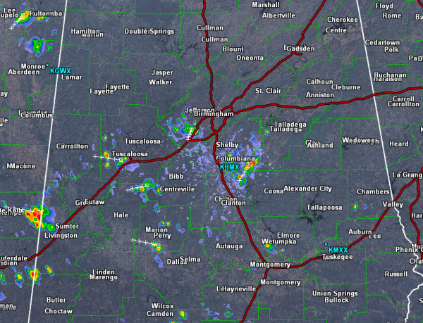
A few isolated storms have develop across the Alabama landscape this afternoon. Just as we have seen all summer, storms are producing very heavy rainfall and frequent lightning. Storms are moving east to west and should not sit over one location too long. A few areas could see some very isolated flash flooding.
Currently, some of the more intense activity is over portions of western Jefferson County as well as southern Shelby County. Most of the other activity is west of Interstate 65 and is impacting portions of West Alabama. Storms are widely scattered and most areas will remain dry this afternoon. Today’s convection should persist until after the sun sets and daytime heating is lost. Storms will then begin to wind down during the evening hours.
Category: Alabama's Weather


