Quick Radar Check
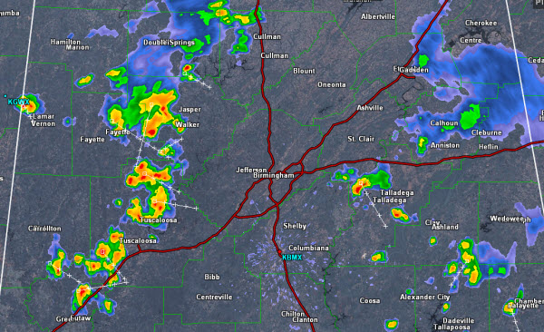
Heading into the afternoon, we are beginning to see more thunderstorms develop over portions of Central Alabama. Over the last hour storms have rapidly developed in Walker, Tuscaloosa and Greene Counties. These storms could be impacting the Birmingham area around 2:30-3:00 PM.
We are seeing some strong storms in St. Clair, Talladega, Clay and Tallapoosa Counties as well. Storms today are fairly intense and are producing tremendous amounts of cloud-to-ground lightning as well as very heavy rainfall. Isolated flash flooding could become a serious issue with some of these storms today.
Today’s activity is pushing off to the southeast as northwest flow continues to drive the weather over Alabama this week. We are watching all convection today as an isolated storm or two could reach severe limits briefly with a chance for hail and damaging winds, but most storms should remain below severe limits.
Category: Alabama's Weather


