More Showers and Storms
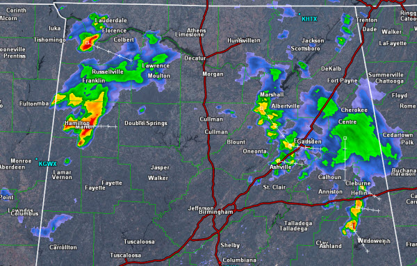
We are watching several areas this midday as showers and storms are beginning to make it into Central Alabama.
Portions of Blount, St. Clair, Etowah, Calhoun, Cleburne, Cherokee, Randolph and Clay counties in East Alabama are seeing some showers late this morning. This activity continues to drop to the east-southeast.
To our northwest, storms are affecting Marion County, but will soon be entering Winston and Walker counties. This activity is heading off to the east-southeast as well.
Today we remain in northwest flow, which continues to allow for wet and unsettled weather across Alabama. There are several complexes of storms to our northwest and we are expecting these complexes to bring us several rounds of showers and storms the next couple of days. Storms will be strong and could reach severe limits briefly, with gusty winds. However, the main concern will be a threat for flash flooding. The entire Tennessee Valley of Alabama, as far south as Cullman County is under a flash flood watch through Thursday morning.
Category: Alabama's Weather


