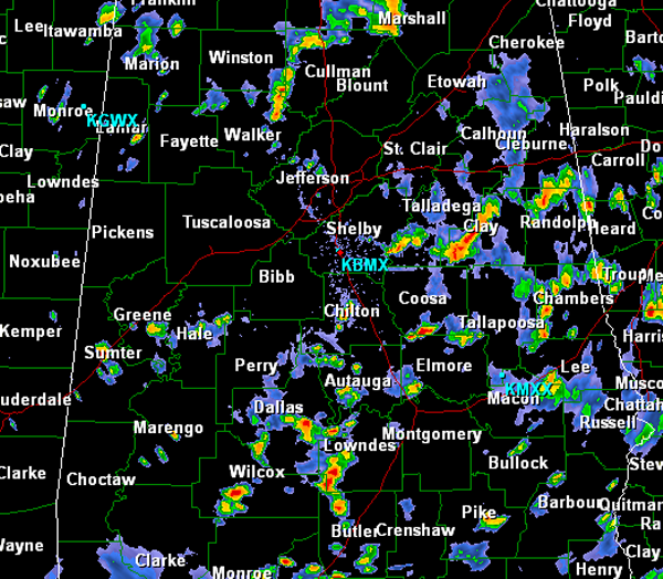
Mid-Afternoon Radar Check
A quick look around Central Alabama still shows widespread scattered showers and thunderstorms ongoing in many areas.
Today’s activity is moving from west to east across the state, something we haven’t seen in a while. Currently, the more intense storms have moved into eastern areas of the state. Portions of Talladega, Clay and Randolph Counties as well as Dallas and Lowndes Counties are seeing very intense rainfall and tremendous amounts of lightning. Other areas around Central Alabama are seeing similar conditions as the widespread convection is ongoing. If you are lucky enough to be caught underneath one of these storms, it will cool you off temporary and drop those temps down into the 70s. However, many locations that are not seeing convection currently are still seeing mostly sunny skies and these areas are baking in the July afternoon sun. Afternoon highs have made it into the 90s in these locations.
For the rest of the afternoon, showers and thunderstorms will persist and should continue to develop as a very moist air mass is in place. Ample daytime heating has allowed instability to increase across the area. Outflow boundaries across the state are proving to provide just enough uplift for this afternoon’s convection to develop.
Category: Alabama's Weather


