Showers and Storms Developing
Scattered showers and storms are developing across the Alabama landscape today. Several mesoscale boundaries, daytime heating, a moist boundary layer, and some upper-level features are providing all the needed ingredients for these showers and storms to develop. Currently, some of the more intense activity is across Etowah and St. Clair Counties, and it appears they are trying to back build into Jefferson County. Also watching convection develop over West Alabama in Lamar and Fayette Counties as well as showers down around Lake Martin along the highway 280 corridor. Showers and storms could develop anywhere across Alabama as a warm stable air mass in in place across the state. Storms that develop could produce small hail, gusty winds, frequent lightning and torrential rains. We could see some flash flood warnings today. There are more storms developing across northern Mississippi as well and should continue to propagate east today and could be impacting Alabama later.
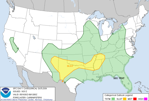
The SPC maintains a slight risk for severe weather over extreme Northwest Alabama. Still watching a MCS moving across Arkansas and expecting additional thunderstorm development with it that could produce large hail and damaging winds. Storms ongoing across the Tennessee Valley have produced some severe weather warnings earlier, but those warnings have since expired. Flash flood warnings are in effect for Colbert and Lauderdale Counties in Northwest Alabama as these storms have produce torrential rainfall across the area.
Category: Alabama's Weather


