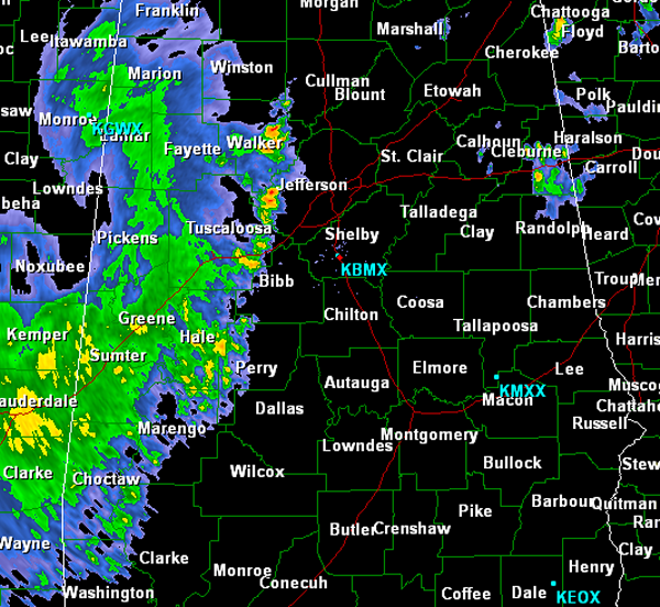
Early Morning Radar Check
Strong, non-severe thunderstorms are impacting Alabama this morning. The line of showers and thunderstorms that were over western Mississippi late last night have continued to push east overnight. They have weakened and as they crossed the state, as expected, and have made their way into Alabama this morning. The most intense activity stretches from eastern Walker County around Cordova into west Jefferson County, south through Vance and down to about Greensboro. The last few radar scan continue to show the storm weakening, but they are producing some gusty winds, small hail, torrential rain and frequent lightning.
This activity will continue its eastward progress over the next few hours. The storms look to continue to dissipate and rain themselves out. We can expect additional development later today as a cold front pushes across the state.
Category: Alabama's Weather


