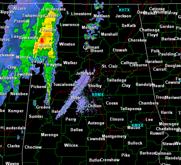
Early Morning Radar Check
The line of showers and storms have made their way into West Alabama, but with the loss of daytime heating and a more stable air mass in place, this activity continues to weaken and diminish as it pushes into the state.
Heavy rain has been falling in Marion, Lamar and Fayette Counties and a band of showers and storms are now pushing into western portions of Tuscaloosa County from Pickens County. None of this activity is severe and we are not expecting any of these storms to intensify. Just expect some heavy rain, lightning and gusty winds.
There are also a few showers developing along Interstate 65 from Cullman north. These are developing along the convergence of two outflow boundaries. We could see additional showers along the 65 corridor as these boundaries interact with each other.
Category: Alabama's Weather


