For the Rest of Tonight
The weather across Alabama is calm and should remain that way for the rest of tonight.
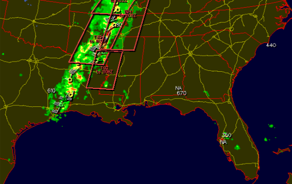
Severe weather will continue through the overnight hours to our west. Tornado watches are in effect from north of St.Louis down the Mississippi River to Natchez. Strong and severe thunderstorms continue along a frontal boundary that is slowly easing its way to the east. Many of the storms have lost some of their punch this evening, but there are still severe storms ongoing in the watch areas. There have been several reported tornadoes in Arkansas and Missouri. There were several tornado warning for the downtown area of St. Louis earlier.
This storm system is moving very slowly. Severe weather should make its way into Alabama by mid-morning. The Birmingham metro should see the worst weather early to mid-afternoon.
Storms will redevelop along the frontal boundary tomorrow. Daytime heating will also cause additional destabilization of the atmosphere across the state tomorrow and we will have to watch as storms should re-intensify. It should be a very busy day for severe weather across the state. All aspects of severe weather will be possible. Damaging winds and large hail will be associated with the squall line that will be swinging through the state. We will have to watch for a few isolated tornadoes within the line and in any thunderstorms that develop out ahead of the main line.
Numerous flash flood warning have been issued tonight as well. Thunderstorms are dropping copious amounts of rainfall in short periods of time. This will be an issue for many areas across Alabama tomorrow too. Most locations could receive 1-2 inches of rain.
Category: Alabama's Weather, Severe Weather


