Showers, Some Thunder
An area of showers, heavy at times, has settled into a west to east orientation across Central Alabama from Pickens and Sumter County in the west into Shelby, Chilton and Autauga Counties over into Clay and Tallapoosa Counties in the east.
There is still some lightning in the western counties, especially near and southwest of Carrollton, but the activity has weakened substantially in the past couple of hours.
There are some moderate to heavy showers in the Tennessee Valley from Guntersville back to Decatur and then over much of eastern Lauderdale and Limestone counties.
Everything is moving east.
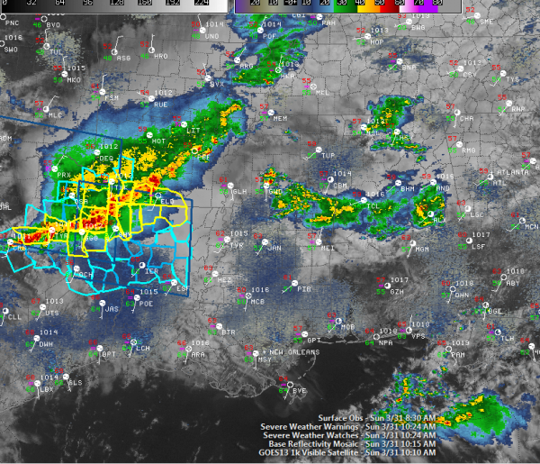
A complex and confusing surface pattern clutters the weather maps this morning across the southeastern quarter of the United States. A collection of surface low centers is over southern Missouri and northern Arkansas. A cold front trails back into the Dallas area. Ahead of the system, a warm front has pushed into Kentucky and is working against the wedge to get across the Smokies into North Carolina.
A QLCS (Quasi-linear convective system), a fancy name for a line of storms, is pushing across southern Arkansas and northeastern Texas into northwestern Louisiana at this hour. There is a severe thunderstorm watch in effect as well as several severe thunderstorm warnings at this hour. There was even a brief tornado warning in northeastern Texas. This activity will weaken and move across Louisiana into Central Mississippi. It should stay well to our southwest.
More storms will fire this afternoon across northern Mississippi ahead of the cold front and these storms will work into Alabama later. They won’t be severe. They should be east of I-65 by 9 p.m. and into Georgia by midnight.
Category: Alabama's Weather


