Noon Valentine’s Update
Happy Valentine’s Day!
Working on the forecast package for J.B. this afternoon as he has some business to attend to. So no M&M story today. But he will be back with a double helping for us tomorrow.
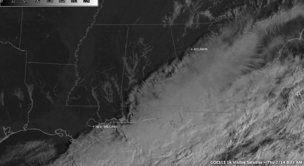
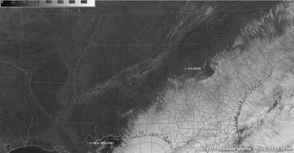
Fog greeted this Valentine’s Day across much of Northwest, West and Central Alabama. It was fun to watch the satellite image this morning, as skies that had cleared last evening filled in overnight with low clouds, only to erode before sunrise over northwestern and western sections.
An you watched the skies clear on the satellite animation, you could see fog symbols popping up like mushrooms! You didn’t need a weather map to tell you it was foggy in places like Tuscaloosa, and over in Pickens County. It was a thick as pea soup!
Visibilities dropped to less than ¼ mile and it was kind of an eerie sight early this morning on the UA campus and in other West Alabama spots. There was even some freezing fog, as temperatures were just below freezing, but no problems were reported.
Here is a dramatic visible satellite image from this morning, showing the fog clearly in the valleys of West Alabama.
A few stratocumulus clouds developed late this morning in the I-59 corridor. They show up clearly now on the satellite imagery as well.
Temperatures are climbing through the lower 50s heading for afternoon highs in the upper 50s. Tonight will not be as cold as last night, with lows in the middle to upper 30s.
Not much change in the thinking for the weekend. Cold Saturday with highs struggling to get out of the 30s. There could be a few sprinkles late tomorrow afternoon and evening and a few flurries Saturday morning. But they certainly won’t cause any accumulation. Just an exclamation point on a raw day! But the cold won’t last long as warmer readings return for Sunday and it looks like we will be heading into a wet, active pattern for the next two weeks with frequent wet weather systems.
Category: Alabama's Weather


