More Rain and Storms
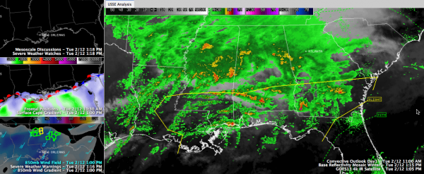
Widespread showers and some elevated storms are spreading northward across Mississippi and Alabama early this afternoon as a surface low along the Texas coast lifts warm, moist air over the colder airmass over us.
The warm front is lying along the Gulf Coast, but it is having a hard time lifting north with all the rain and cool air in its way.
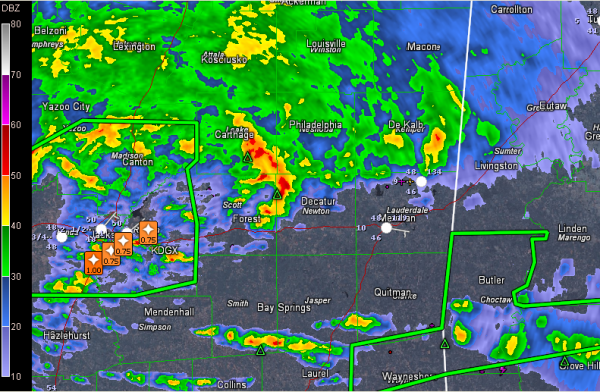
There is a strong low level jet penetrating up into Mississippi. At about 5,000 feet, winds are blowing at 40-50 mph out of the Gulf, up over southeastern Louisiana and into southern Mississippi. You can see that in the lower left panel of the image above. Thunderstorms along the nose of that low level jet have been strong to severe. That storm east of Jackson has had severe thunderstorm warnings on it. You can see the steady stream of hail reports it has been dropping in its wake. It has weakened below severe limits.
The storm further to the east, about to enter Sumter County, is not severe, but is capable of producing small hail and gusty winds. It is also producing copious amounts of lightning. This storm will pass near or just north of Livingston between 1:30-1:45.
The storm east of Jackson will reach Philadelphia between 1:40 and 1:45 and Pickens County Alabama around 2:30 p.m.
Severe weather will be most likely over South Alabama, as well as southeastern Louisiana, southern Mississippi, southern Georgia and parts of northern Florida in the unstable air down there. That is not good news for Mardi Gras celebrations in New Orleans and Mobile and elsewhere along the Gulf Coast.
The rain is the main story, with flash flood warnings continuing for several South Central Alabama counties from Choctaw over to Wilcox. All of Central and South Alabama is under a flash flood watch as well.
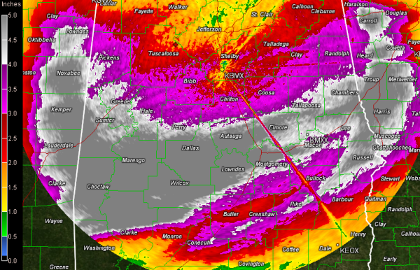
Look at these Doppler radar estimates on rainfall since early Sunday morning.
The gray color represents estimates of 5-7 inches of rain during that time. Unfortunately, some more heavy rain will move over some of those same areas this afternoon.
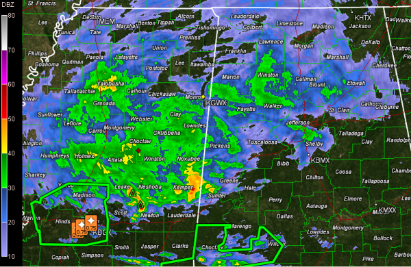
Moderate to occasionally heavy rain will overspread much of central Alabama through the afternoon, making for miserable driving conditions. Allow extra time if you will be out and about this afternoon and evening, and slow down. Here is what you have to look forward to:
Category: Alabama's Weather, Severe Weather


