A Few Miles Makes a Difference
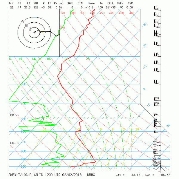
The morning soundings are in and they certainly tell a great story. Here is the Birmingham sounding taken at the Shelby County Airport in Calera.
As you can see, the temperature line (red) and the dew point line (green) are a respectable distance apart indicating that the air is fairly dry – not bone dry, but probably enough to evaporate most of any precipitation that might fall. Also, the sounding from about 800 millibars down is above freezing.
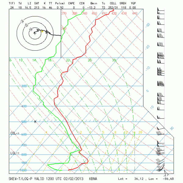
The Nashville sounding, on the other hand, is moist especially above 800 millibars, and the temperature aloft is below freezing except for a very small layer just above 900 millibars.
The big question, of course, is exactly where the atmosphere transitions. Based on surface reports, much of the radar echoes showing up on radars along and just north of the Tennessee River are sleet and freezing rain. The echoes just south of the Tennessee River are probably also sleet and freezing rain, but the atmosphere may be a little too dry for now for that precipitation to reach the ground. This may change through the mid morning hours as additional precipitation falls into the dryer air causing the humidity of that layer to rise.
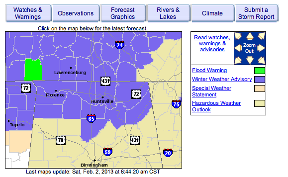
In response to this information, the NWS Huntsville office has extended the winter weather advisory further east as well as extending the time for icing conditions until 2 pm as shown by the purple area in the map below.
-Brian-
Category: Alabama's Weather


