What to Expect Overnight
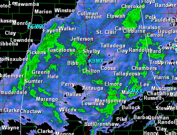
Looking at this overall event. Much of north Central Alabama continues to remain in stable air as rain has been falling most of today. Rain is beginning to taper off in our northwestern counties and should begin to taper off in Central Alabama. Rain and thunderstorms will redevelop and become widespread again during the early morning hours.
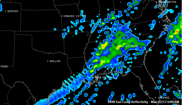
Looking at the simulated radar for in the morning, rain and thunderstorms will be over much of Central Alabama. Some of the heavier storms look as though they could be off in some of northwestern counties. Could be a messy commute in the morning. Storms should be strong and once again these storms could reach severe limits. Some heavier activity will also be off to our southwest along the Highway 80 corridor. The storms will be moving to the east through the morning and should be exiting Alabama by early afternoon .

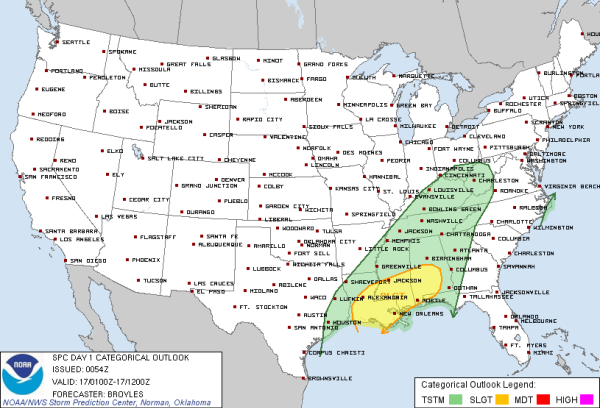
Many areas to the south and west of the Birmingham metro continue to be under a slight risk for severe weather. The current risk is valid until 6 AM Central Time. Upper level forcing dynamics will be moving in across the state tonight. Still think there is a good chance of some severe weather overnight and into tomorrow morning. As the better dynamics move through, strong storms will be possible in our area, with some storms possibly being severe. The more widespread severe weather threat will be across our southern counties. Main threat will still be damaging winds and the chance for some isolated tornadoes. Flooding will continue to be a threat as well. Some isolated tornadoes are still possible within the risk area. You do not have to be in a risk to have severe weather. Any location in or near this risk should keep a careful eye on the weather during the overnight hours.

Category: Alabama's Weather


