Late Night Look
Not much change in the thinking late this evening.
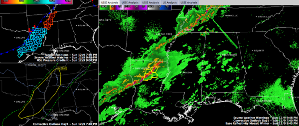
The northern part of the line of storms is now into western Tennessee around Memphis. Recently saw a report of some dime sized hail at I-40. So the storms there are not severe.
This line weakens the further southwest you go.
But what appears to possibly be an MCV is over northern Louisiana near Monroe. This mesoscale convective vortex has the potential to produce damaging winds as it pushes northeast across Mississippi. It should reach Tupelo around 3 a.m. and the northwestern corner of Alabama around 5 a.m.
Just saw a report of tree and power line damage near Jonesboro LA. Makes sense.
The SPC just mentioned that they may extend the current severe thunderstorm watch into West Central Mississippi later. They put the odds at about 40% that they will issue a new severe thunderstorm watch into Mississippi before the current watch expires at midnight.
Otherwise, the trailing line of storms will push into western Alabama during the morning hours. While widespread severe weather is not expected with the main line, there will probably be a few severe thunderstorm warnings.
Category: Alabama's Weather, Severe Weather


