Downright Warm!
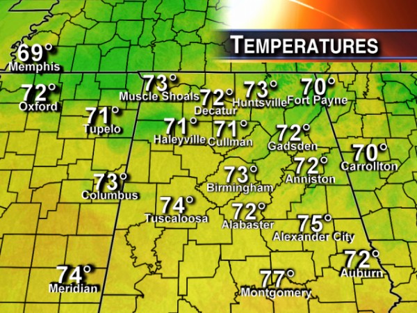
At 2 pm CST, temperatures across all of North and Central Alabama had reached values above 70 degrees. Tuscaloosa was once again one of the warmer spots at 74 degrees.
While there are signs in the long term, that is, beyond 7 days, that the weather pattern may change to something much colder, we are still in for about a week of mild, dare I say warm, weather. The 30-year average high for Central Alabama based on data at the Birmingham Shuttlesworth International Airport places the seasonal high at 60 degrees. So we are running about 10 to 15 degrees above values typically expected in early December.
Looks like we should see some rain late Tuesday and early Wednesday across much of the area with the passage of a cold front and an associated weakening line of showers. Rain chances should be the best from about 7 pm on Tuesday evening through around 6 am on Wednesday. Rainfall amounts are not expected to be very high with most spots receiving about a quarter of an inch, perhaps as much as a half inch for areas in the northwestern quadrant of the state.
While we will cool down a little, temperatures are expected to remain above seasonal values through next weekend.
Category: Alabama's Weather


