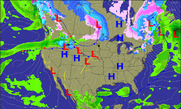
A Look at the Weather Map
High pressure is in control over much of the Eastern half of the United States. That is keeping beautiful and sunny conditions in place, but very cold conditions too. It is also responsible for our breezy north winds today. The cold front that brought in the colder weather has now pushed off the East Coast. The cold weather in place will be short-lived. As the high pressure pushes off to the east by late Sunday and will allow for warmer and more moist air to move back in.
In the Northeast today, the lake effect snow machine is piling up the snow on the south side of lakes Ontario and Erie. Conditions should begin to improve overnight and snow fall rates will begin to tamper off. Our next cold front and storm system is beginning to take shape in the Northern Plains. This front will continue to work south and east over the next few days and will likely cause some showers and thunderstorms across the Southeast Monday and into Tuesday. After that we can expect to return to cooler, drier conditions before our next storm system that could be in here for next weekend.
Category: Alabama's Weather


