Severe Weather Today and Tomorrow Off to Our West
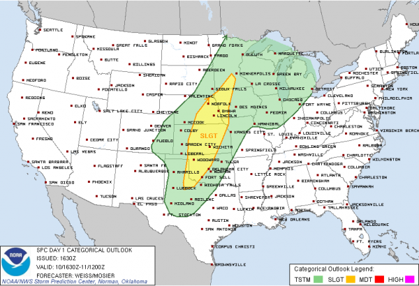
A very strong low pressure system with a trailing cold front will be ushering in a some much colder air across much of the United States this weekend and into next week. This system will be moving out from the Rockies today and as it gets out into the Plains, quite a bit of severe weather is expected today. You can see by the risk outlined by the SPC that anywhere from west Texas to southern Minnesota will have a threat today. This region looks as though it will experience damaging winds, large hail and even the threat for some tornadoes, especially early in the severe weather event. At first, supercell thunderstorms should develop and those are the ones that will need to be watched for the the threat of tornadoes. These storms should merge into a squall line as we head into the overnight hours.
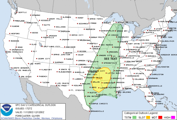
For Tomorrow the threat will be shifting further south and east. As you can see the SPC has a large portion of the Red River Valley and the Lower Mississippi River Valley under a slight risk for severe weather tomorrow. Little Rock, Shreveport are under the gun with this risk and maybe Memphis by late in the evening. The squall line from today’s activity should be ongoing tomorrow morning. Storms could have the potential to produce large hail, damaging winds and a brief tornado or two. This system warrants watching as these storms could be impacting central Alabama early Monday morning.
Category: Alabama's Weather


