Leftovers
Isaac left plenty of leftovers for us here in Alabama. Leftovers in the form of humidity.
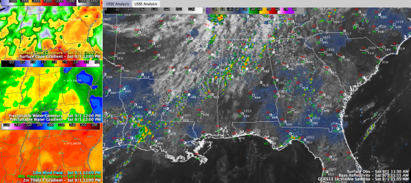
The moisture is best characterized in a plot of precipitable water (left middle image), which show an axis of high values over the northwestern half of the state, north and west of I-59.
Most folks awakened to sunshine this morning, and that is heating the lower atmosphere. Temperatures are shown in the lower left panel.
Showers started forming when temperatures reached the middle 80s. Some of them will become storms, but instabilities (top left panel) shouldn’t get out of hand.
At noon, lightning was being observed over northern Jefferson County near I-65 around Warrior and Morris. These storms extend up into Blount County. Another storm was forming in southern Fayette County, and others are not far from becoming electrical just west of the Tuscaloosa Airport.
There is little shear, so the showers won’t organize, but they could produce brief heavy rain.
Radar echoes are moving east northeast at 20-25 mph.
Highs will reach the upper 80s.
Category: Alabama's Weather


