Hook, or Slice?
FAST FACTS AT 10 AM:
———————————————–
LOCATION…23.9N 80.8W
ABOUT 80 MI…130 KM SE OF KEY WEST FLORIDA
ABOUT 110 MI…180 KM ENE OF HAVANA CUBA
MAXIMUM SUSTAINED WINDS…65 MPH…100 KM/H
PRESENT MOVEMENT…WNW OR 300 DEGREES AT 18 MPH…30 KM/H
MINIMUM CENTRAL PRESSURE…995 MB…29.38 INCHES
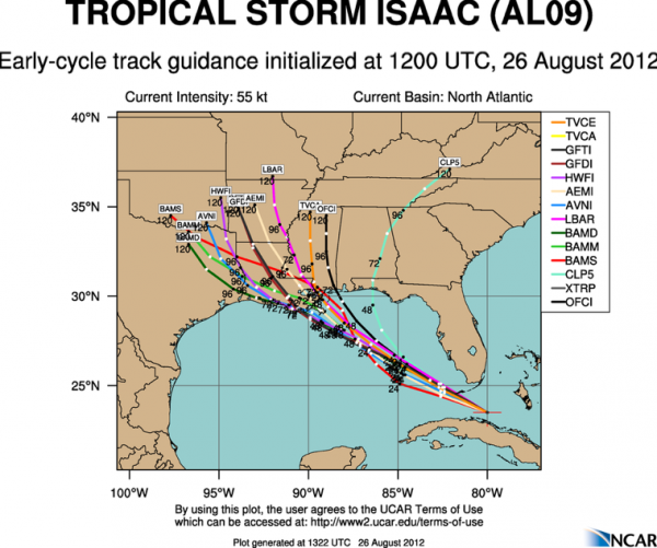
The new NHC track forecast is in, and not surprisingly, it has been shifted a little further west, reflecting the more westerly trend that developed yesterday afternoon in some of the models.
The early output from some of the models is in, and it is heavily weighted with the westerly trend.
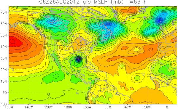
The NHC discussed the wide difference in the two main models. There is a wide difference between the GFS and the European solutions. Here are the two depictions. First the GFS, which takes the hurricane to Southeast Louisiana.
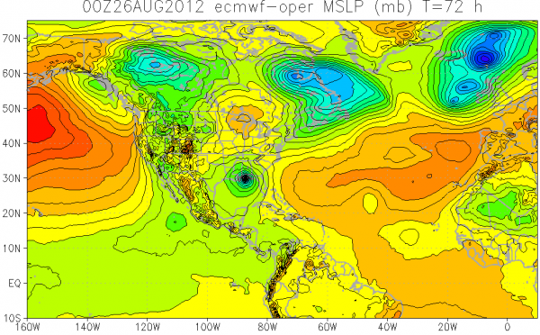
Here is the European, which takes it to near Fort Walton.
So, it is like two golfers standing at the tee. One has a terrible hook in his shot, which drives the ball left. The other has a slice that takes to the ball to the right. If you averaged their shots, the ball would go down the fairway. But we know it probably won’t. The ball is going right or left. The National Hurricane Center has the unenviable position of having to forecast where the ball is going, and until it is hit, and until the clubface hits the ball, they can’t say. So for now, they lay down a track forecast down the fairway with that big cone of uncertainty and wait for the ball to be struck.
LATE NOTES:
Hurricane watch is already in effect along the coast from east of Morgan City to Indian Pass, Florida.
The center appears to be reforming just southeast of the Florida Keys. Storms are starting to form over the center. A dominant center appears to be forming on the Key West Radar. If this happens, strengthening will begin.
The NHC forecast calls for gradual strengthening with intensity at landfall around 105 mph, making it a high end category two. It could be much stronger. Remember, there is not much skill in forecasting intensity change.
Important to note that the HWRF output indicates an arrival of the center in southeastern Louisiana around sunrise Tuesday. This is much faster than the official forecast.
Category: Tropical


