Rain and Storms Out There
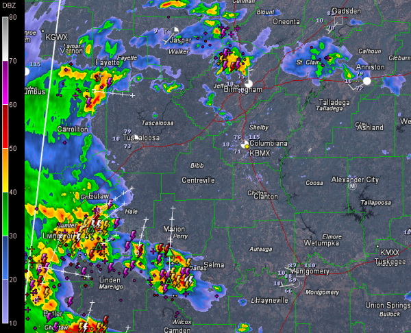
A surface low over Central Mississippi is triggering an area of showers and storms over West Central Alabama at this hour. They are moving northeast and will overspread much of the area, in opposition to what we thought earlier.
They are over parts of Lamar, Fayette, Pickens, Greene and Sumter Counties and extend southward from there.
Nothing severe, just lots of lightning and heavy rain and the potential for strong gusty winds.
To the north, showers and storms are scattered from Walker and Winston Counties through northern Jefferson, Cullman, Blount, St. Clair and Calhoun Counties. There is a pretty good cell near Fultondale and Gardendale. It is pushing toward the Center Point and Trussville areas. Plenty of lightning and heavy rain with these too.
So, keep an eye to the radar if you are heading out and about this evening, or just stay home and enjoy the rain and thunder.
Category: Alabama's Weather


