Showers and Storms Growing
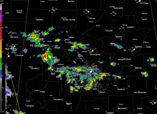
Showers and thunderstorms are becoming more widespread and heavier across North Central Alabama at mid-afternoon. Apparently, they may be forming as convergence increases along a stalled frontal system from Jackson MS to north of Birmingham.
At 3 p.m, there were over parts of Lamar, Fayette, Walker, Jefferson, St. Clair, Pickens, Tuscaloosa, Bibb, Shleby and Chilton Counties.
The heaviest storm was over northwestern Tuscaloosa County near Moore’s Bridge. Others were heavy around Bibb, southern Shelby and northwestern Chilton Counties.
Everything was moving east or east southeast.
Nothing severe, just brief heavy rain and some lightning. Can’t rule out one of them going rogue and become severe this afternoon however.
The new slight risk area was just issued. It is about the same, edging into southern Sumter and Choctaw counties in West Central Alabama.
Category: Alabama's Weather


