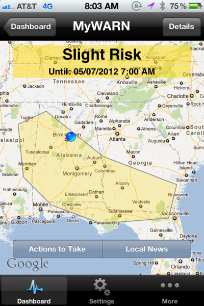
Alabama Back in Slight Risk Today
 For the second day in a row, Alabama was not part of the initial Day One Severe Weather Outlook from the Storm Prediction Center, which is issued around 1 a.m. CDT, but was in a subsequent issuance.
Yesterday, we weren’t in the midnight one, but got included in the 16:30z issuance (11:30 a.m. CDT).
Today, we weren’t in the 06:00z (1 a.m.) version, but got upgraded on the 13Z (8 a.m. CDT) edition.
The slight risk covers parts of the southeastern U.S. from Mississippi and Alabama into Georgia and northern Florida. This activity is in a warm, moist airmass ahead of a rare southwestward moving frontal boundary over Alabama and Tennessee this morning. Places like Birmingham, Tuscaloosa, Montgomery, Dothan, Albany, Tallahassee and Valdosta GA are in this risk.
It is like the SPC forecasters drew the risk area so that it would just miss the Talladega Superspeedway. I am sure they didn’t, that’s just the way it fell, since the boundary responsible for the morning storms is pushing southwestward away from the track and there shouldn’t be any severe weather there today.
A slight risk means there is a chance of severe weather at locations in the alert area. People in the alert area should monitor conditions throughout the day in case watches or warnings are issued for their location. You should plan your activities with the weather in mind. Don’t change your plans, but just think about the impact weather could have and what you will do if severe storms do occur.
Category: Alabama's Weather, Severe Weather


