Tropical Plume
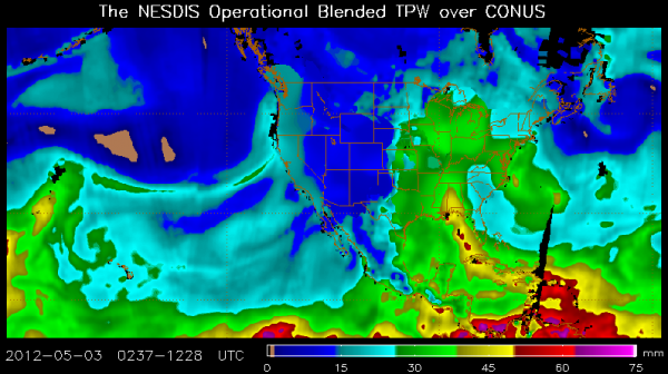
You’ve heard us refer to the plume of tropical moisture over the past day or so, and here you can visualize it using the NESDIS Blended Total Precipitable Water product.
It shows the amount of water available in the atmosphere above any point if that water could all fall as precipitation. A nose of 2 inch amounts extends up into southwestern Alabama. Following the plume, you can track it all the way back to western Cuba and then into the Caribbean.
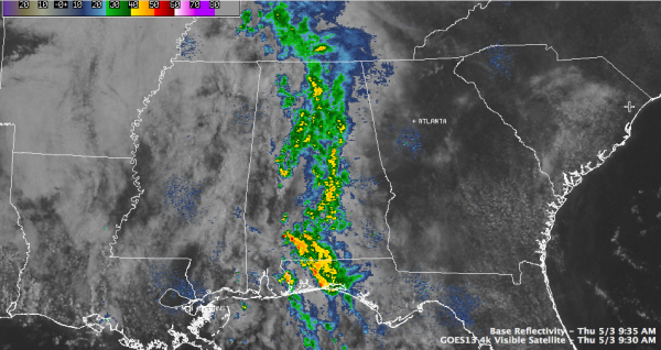
It is being drawn northward by a strong subtropical high pressure area centered off the coast of Georgia and South Carolina. A nice little upper level disturbance over northeastern Mississippi and northwestern Alabama is providing the lift to produce a nice band of moderate to heavy showers from the western Florida Panhandle straight northward through the middle of Alabama.
Some drier air is working in from the west, but hopefully the low will lift more north and north northeast and keep more of Alabama in the precipitation pattern through the day. The breaks in the clouds will actually help to create a temperature boundary over western Alabama that will fire more showers and storms during the day. You can see the heavier radar echoes now over southern Alabama about Evergreen.
The rain, alebit mostly light so far, is a sight for sore eyes for parched lawns, gardens and farms across the state. Alston Keith reported 0.51 this morning in Mountain Brook. The Birmingham Airport had 0.48 inches through 9 a.m.
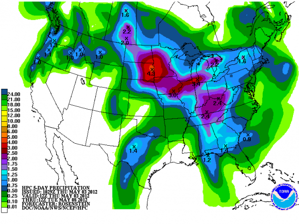
The axis of heaviest rain for the next 24 hours should be right up I-65 from Chilton County northward, with lesser amounts to the west and slowly tapering amounts to the east. Here is the morning QPF chart from HPC showing forecast rainfall over the 24 hours from 7 a.m. today until 7 a.m. tomorrow.
Category: Alabama's Weather


